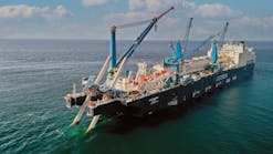
Texas-based Discovery Geo (Australia) Corp. will use the 3D seismic shipVeritas Viking II to shoot a 600 sq km survey starting in early March, according to operations manager Bruce Morris.
Morris said, "The Veritas Viking would definitely be collecting data for Discovery Geo in PEP 38479 and tentatively in PEP 38471."
PEP 38479 is a long narrow permit near the north Taranaki coast, south from the Kawhia Harbor to the Awakino and Mokau river mouths. PEP 38471 lies immediately offshore from Cape Egmont, south of New Plymouth.
Morris said, "The seismic work would include gathering data over the Awakino prospect and a broad fan system."
TheVeritas Viking is currently undertaking an 1,100 sq km 3D seismic acquisition program for the larger US independent Pogo Producing Co. in its three offshore north Taranaki permits.
The three 100%-owned Pogo permits are PEP 38490, PEP 38489, and PEP 38488.
Pogo's seismic acquisition program with theVeritas Viking began on Jan. 13 collecting data.
Pogo's 4Q 2004 report said the final data processing from the Taranaki program would be thoroughly analyzed by the company's international geoscience team.
"That analytical program should lead to a meaningful exploratory drilling program in the northern Taranaki basin by early 2006," the report said.
Pogo chairman Paul Van Wagenen said in 4Q 2004 report that although the 2005 capital and exploration budget at $345 million was lower than 2004's $486 million, a high proportion of spending last year was spent on development wells rather than exploration wells. In 2005, a much larger proportion of Pogo's total drilling dollars will be directed to exploration.
03-02-05
