Geco adding 100 km of streamers
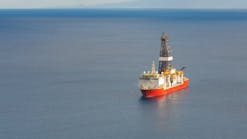
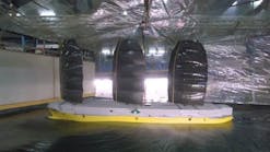
Geco-Prakla is in the process of adding more than 100 km of new streamers to its fleet of 16 3D vessels. Upon completion of the installations, seven of the vessels with at least six long streamers will be configured with an unparalleled 750-meter spread, or minimum separation between outer streamers. Three vessels capable of pulling at least six streamers will have a 500-meter spread, and six other vessels with four or five streamers will have 300-meter minimum spreads.To equip the fleet even further to meet almost any acquisition requirement, Geco is outfitting nine of these vessels with new instrument rooms that carry the Schlumberger Trilogy onboard data management system and is installing permanent satellite links into the company's private global communications network.
- Post stack seismic showing Glauconite thinning into Jurassic High. [25,959]
- Constrained Sparse Spike Inversion reveals additional structural and stratigraphic detail, which was ambiguous in the post stack data. [29,233 bytes]
- Impedance Results with Seismic overlay and sequence boundaries re-picked. [27,392 bytes]
Western gets new nav ware
Western Geophysical is installing new, state-of-the-art navigation software in its high-tech 3D vessels. Last year, the company equipped its Western Monarch with Concept Systems' Spectra integrated navigation system and Reflex binning software as a part of a scheduled upgrade to assist in the management and QC of navigation data acquired during seismic acquisitions. This year, Western is putting these software systems on board its Western Kenda, Western Atlas, Western Regent, Western Patriot, and Western Legend.Western going for Angolan deepwater spec
A new, 14,300 km non-exclusive seismic survey is being carried out in the deepwater zone offshore Angola, spotlighting known and suspected oil and gas prospects. Being shot by Western Geophysical's vessels Western Cove and Western Wave, the acquisition is focusing principally on open acreage in water depths ranging from 1500-3000 meters, beyond the existing line of designated blocks 14-24, and an area that was announced at this year's OTC to be offered later this year. The Cove is shooting 11,000 km of 2D data with a single 6,000 meter cable, while the Wave is shooting 3,300 km of data in the acreage beyond blocks 26-30. Western completed acquisition of a 1,200 sq km non-exclusive 3D survey in December on Blocks 5 and 6. Processing of all data is underway.PGS shooting first Aussie multi-client survey
Petroleum Geo-Services will be conducting Australia's first multi-client 3D seismic survey during the fourth quarter of this year, now that the Australian government has extended the confidentiality period on seismic data from two years to eight years. The shoot will cover some 3,100 sq km over the Canarvon Basin on Western Australia's Northwest Shelf. Woodside Offshore Petroleum, the principal sponsor of the survey, worked closely with PGS from conception to commencement, including its design and implementation. The PGS vessel Nordic Explorer will carry out the acquisition in two phases, with completion before the end of the year.PGS to perform largest reservoir evaluation project
In an effort to reverse declining production on its Bombay High Field, India's Oil & Natural Gas Corp. has awarded PGS the world's largest reservoir evaluation - performance of a 1,750 sq km 3D acquisition, processing, and interpretation project at a cost of US$50 million. Three divisions of PGS will be involved: PGS Ocean Bottom Seismic, which will acquire the data, PGS Tensor, which will process it in India on one of its massively parallel processing supercomputers, and PGS Reservoir, which will conduct an interpretation of the Bombay High's reservoir characteristics using the newly acquired data and existing well and production information. Acquisition begins in September, with interpretation to be completed by the end of 1998.Ensign processes giant 3D West of Shetlands survey
Ensign Geophysics has just completed processing one of the largest proprietary 3D surveys ever done in the UK. The project, awarded by operator Shell UK Expro on behalf of its consortium (BP, BG, Conoco, Mobil, and Texaco), consisted of processing approximately 115,000 subsurface km of 3D data covering 2,250 sq km of Blocks 208 and 214, West of Shetlands. The demand sequence included application of Ensign's Wavefield Reconstruction, a patented technique for generating additional seismic records between those actually recorded, radon transform demultiple, 3D dip moveout, and pre- and post-stack time migration. Data quality was very good.Software Latest version of VoxelGeo available
CogniSeis has just released the latest version of its VoxelGeo 3D volume visualization software. VoxelGeo 2.1.7 is a significant step ahead of its predecessor. Numerous new capabilities are added and several enhancements have been made following customer requests. "Chief among the many new features and enhancements," said Bob Wentland, production manager, "is its full support for CogniSeis' Uniform Links Architecture to SeisWorks, IESX, and Charisma interpretation databases, which provides complete read/write access to these databases, allowing modifications made in VoxelGeo to be stored back in the original interpretation database."The upgrade also includes a new internal animator to let users easily generate movie images of VoxelGeo data while viewing or analyzing the volumetric data. It includes a new multi-volume rendering capability that permits multiple data volumes to be displayed simultaneously in the same 3D space, allowing easy comparisons. And it includes a new 3D cursor, making it easier to locate and interpret data clouds within a 3D volume.
Copyright 1997 Oil & Gas Journal. All Rights Reserved.
