Gene Kliewer • Houston
Asia-Pacific seismic activity
Cairn begins 3D Sri Lanka survey
A seismic survey in Mannar basin of Sri Lanka is underway by CGGVeritas forCairn Lanka Private Ltd., a subsidiary of Cairn India.
Data acquisition over the 1,450-sq km (560-sq mi) survey area is expected to be complete in the first quarter of this year with processing complete by mid-year. Drilling then is anticipated in the first half of 2011.
Cairn’s block SL 2007-01-001 is off western Sri Lanka in water depths from 400 m to 1,900 m (1,312 ft to 6,234 ft).
Otto begins 3D survey off the Philippines
Otto Energy Ltd. was scheduled to start a 3D seismic data acquisition program over 590 sq km (228 sq mi) of the southwestern part of SC55 in the Palawan basin, Philippines.
Purpose of the survey is to develop the Hawkeye structure along with several other leads in the license.
SC55 in total covers 9,000 sq km (3,475 sq mi) in the southwest part of the basin.
OBC comes to Saudi Arabia
CGGVeritas says ARGAS, its joint venture with TAQA in Saudi Arabia, has won two Saudi Aramco contracts totaling $375 million for ocean-bottom cable 3D data acquisition projects.
The first project is scheduled to start in June and run for two years. The second project is scheduled to start in October and also last two years. The projects aim to cover an initial 6,000 sq km (2,317 sq mi) in Saudi water depth of 20 m to 60 m (66 ft to 197 ft) in complex environments with producing oilfields and active shipping lanes.
ARGAS plans to mobilize two independent OBC crews equipped with Sercel SeaRay 4C equipment and recording systems.
BP gets onboard processing off Libya
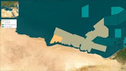
Geotrace has completed an onboard data processing project for BP’s Sirt basin concession, offshore Libya.
The 3D marine survey in Libya’s Gulf of Sirt covered 17,500 sq km (6,756 sq mi). The contract split the area into four tracts and covered onboard processing, including 2D SRME and full pre-stack time migration with velocity model picking, within six weeks of last shot for each tract.
In addition to the conventional pre-stack time processed data, Geotrace processed and delivered a high resolution shallow hazard cube onboard the vessel, and conducted a multiple-azimuth test run over a subset of the full survey area.
The company used its proprietary ANSER and Diamond software systems and a high capacity PC cluster based on a Dell M600 blade cluster with 2048 CPUs for quality control and processing services including pre-stack imaging and advanced demultiple techniques.
TGS begins Justice GoM WAZ project
TGS-NOPEC Geophysical Co. (TGS) has begun seismic acquisition for the Justice Wide Azimuth (WAZ) 3D project in the Gulf of Mexico. Justice is a northeast expansion of the existing and contiguous Freedom and Liberty WAZ projects.
The survey adds more than 7,800 sq km (3,012 sq mi) of WAZ coverage to the TGS portfolio and covers portions of the Mississippi Canyon, Viosca Knoll, and De Soto Canyon.
Acquisition will continue throughout the first half of the year. Upon completion of the project, TGS will have more than 27,000 sq mi (10,425 sq km) of WAZ 3D in its data library.
Survey for Pemex sets record for CGGVeritas
In the first segment of a 3D seismic program for Pemex in the Gulf of Mexico over the Han Sur-Oeste de Tamil section CGGVeritas says itsAlizé achieved a one-day production record of 117 sq km (45 sq mi). The overall survey program is ongoing.
This was despite the severe winter weather encountered. The high-end vesselAlizé deployed 12 Sercel Nautilus-Sentinen steered solid streamers in one of the largest receiver arrays available at 12 x 8-km x 100-m (12 x 6.2-mi x 328-ft) configuration.
CGGVeritas says the positioning and streamer steering reduced the infill requirements by keeping the streamers consistently separated at a controlled depth.
“TheAlizé’s deployment of a combination of advanced Sercel Sentinel solid streamers and Nautilus is setting a new benchmark for safer operations, quieter data and better crew efficiency, says Robert Brunck, chairman and CEO of CGGVeritas.
The 3,882 km (2,412 mi) Halmahera non-exclusive 2D seismic survey offshore Indonesia is underway with final processing scheduled for completion in May 2010. The survey aims to cover a 15 km x 15 km (9.3 mi x 9.3 mi) long-offset seismic grid over 32,000 sq km (12,355 sq mi) of South Halmahera basin. Aim is to determine prospective petroleum opportunities
