Charles Nguyen, Srivinas Jasti, Eric Theriault - TGS-NOPEC Geophysical Co.
TGS-NOPEC Geophysical Co. is releasing internally a new company-wide mapping framework incorporating two platforms developed by the company’s information technology (IT) staff working in Houston and the corporate headquarters in Asker, Norway.
One platform allows external users to view TGS data via the Web using a 3D globe viewer, while a second enables internal users with little knowledge of dynamic mapping technology to create high-quality field maps on the Internet by reusing shared computer code.
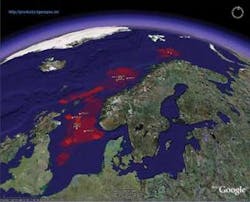
Sample map combining data from TGS’ seismic project library and Google Earth.
The 3D global viewer for external users consists of a series of software tools to publish data in a way that makes it easy for non-technical customers to quickly access and view TGS data using Google Earth software. The reusable mapping platform for internal application developers blends ESRI’s new ArcGIS Server 9.2 software, Microsoft .NET Framework, and AJAX Web development techniques. The ESRI platform eventually may replace many Web-based mapping applications now used by TGS and customers. TGS’ previous mapping applications have similar functions but are independent and use different technologies. Eventually, the company’s IT staff will have fewer applications to support.
The new reusable mapping platforms will allow TGS to migrate to a single, unified mapping framework that shares code and data across applications. The platforms also can embed maps into existing applications and can make them more interactive and user-friendly, while providing more filtering capabilities, better printing and exporting faster performance, and better security.
The move is part of a global effort to provide both TGS employees and customers with easier access to the library of geosciences data maintained by TGS. Among other IT initiatives, TGS also is developing a new, secure Web-based operations portal for clients and a new external Website for clients.
Mapping is fundamental
Powerful, flexible mapping is fundamental to effective decision-making at many levels in oil and gas exploration and development because it can combine the key geophysical, geographic, logistical, and strategic data that define a prospect or project into a single, comprehensive visualization.
For a global provider of non-exclusive seismic data, well log information, and derivative analytical products and services such as TGS – which manages databases containing more than 1 petabyte of seismic data alone – mapping applications are crucial to link data libraries to employees and customers.
The mapping platforms will make TGS data more accessible to a wider audience and will allow users to map newly inputted data sooner. In addition to expanding the breadth of mapping functions, developers also have made the applications more user-friendly.
Developers initially considered many mapping platforms before settling on ArcGIS Server for the internal platform and Google Maps for the external solution. Developers chose Google Earth because it is consumer friendly even though it does not have all the technical functions of the internal mapping system.
Mapping solutions
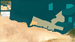
The internal mapping solution enables users to frame any portion of a location covered by data, zoom in to pinpoint a precise area of interest, add whatever interpretive data are desired, and then print a professional-quality custom PDF map, file the customer map away, or send it to a business associate, all with the touch of a button.
The IT staff chose ESRI software because it appeared to have the most straight-forward process to create the shared vision. TGS data already were stored in ESRI formats, and the IT team has experience and technical expertise with the technology. Also, ArcGIS Server could enable a rich set of features for oil and gas applications, including sophisticated labeling, dynamic segmentation, and complex geo-processing.
Perhaps the most important deciding factor was ESRI’s recent release of ArcGIS Server 9.2 application development framework using Microsoft .NET and AJAX technologies which promises to simplify integration of the new mapping capability with other ESRI tools already in use at TGS. The company decided that by adding the data library on top of Google Earth, customers could quickly identify areas of interest and zoom in to get information about specific data products.
The development staff created tools to search internal ESRI databases and to display data on the Google Earth 3D globe so viewers can display data from the library quickly.
Development and finding solutions
TGS IT developers anticipated it would be easier to develop a reusable mapping platform based on ArcGIS Server than ESRI’s earlier map applications in part because ESRI had developed an advanced application program interface, ArcGIS Server 9.2 ADF that makes it easier to create applications for streaming maps to the Web and provides more sophisticated Web controls.
In May 2004 ESRI released ArcGIS 9.0, which included ArcGIS Server and ArcGIS Engine for developers. The current version, ArcGIS 9.2, was released in late 2006. The relative immaturity of the mapping technology means that few developers had experience with it. TGS also found that ArcGIS Server 9.2 was incompatible with many third-party add-on software programs and scripts that worked with the older ESRI architectures.
As a result, the ArcGIS learning curve was steep for TGS developers. Because ArcGIS Server 9.2 is new, little written information is available about using it or developing applications based upon it. TGS developers went as far as available documentation could take them, experimenting with sample applications and running mock scenarios to see how various features and interfaces worked. Many of TGS’ solutions were theoretical.
Whenever TGS developers ran into issues they could not solve, ESRI’s user community provided feedback or support in the form of examples, forums, and reports. TGS found the ArcGIS Server 9.2 technology was so new that many other developers were struggling with similar issues. Some developers concluded applications based on the mapping technology were too complicated and they gave up.
Development of the Google Earth tools were streamlined by the work performed previously for the internal mapping platform. By reusing key components, IT was able to pull data for mapping from TGS’ databases and reformat them for consumption by the Google Earth application.
Developers finished writing the reusable mapping code in October 2007 and released the first iteration of the platform in November. Release of the final version was in February. TGS currently is training members of the TGS staff on the program. The Google Earth viewer was finished in May and is undergoing testing for a planned release this month.
Despite the bumps encountered during development and implementation, TGS is satisfied that both mapping platforms comprise a viable solution for complex, data-intensive applications. The decision to create a generic mapping framework was more resource intensive, but allows code sharing which will speed development of additional applications while streamlining and simplifying TGS’ IT operations.


