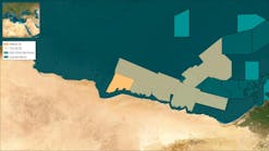
A3D seismic survey has commenced in license area EL 0037 offshore Namibia, says Pancontinental Oil & Gas. The 3D acquisition will cover 3,000 sq km (1,158 sq mi) and a second acquisition phase of 2D data will cover approximately 1,000 line km (386 mi). The total acquisition is expected to take up to 120 days.
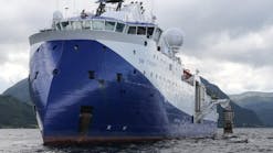
The survey is managed by the EL0037 joint venture operator Tullow Oil, using the seismic acquisition vesselPolarcus Asima.
Tullow Oil farmed-in to EL 0037 in September 2013 and subsequently identified a number of geological leads to be covered by the 3D survey.
Pancontinental retains a 30% free-carried interest through the surveys and one optional well to be drilled by Tullow, for Tullow to retain its 65% interest. Pancontinental estimates that Tullow's farm-in expenditure may be up to $130 million for the full program.
Eco (Atlantic) Oil & Gas has an updated resource report on block 2012A (Cooper) in the Walvis basin offshore Namibia.
According to Colorado-based Gustavson Associates, the P50 best estimate is 4.5 Bboe of gross prospective oil over the existing targets.
The report evaluated an additional 700 km (435 mi) of recently acquired 2D seismic data. Eco retained PGS in the UK to work with its internal team to complete a new detailed geological and geophysical interpretation of Cooper.
Overall, the report is based on interpretation of more than 1,450 line km (901 mi) of 2D data and an analysis of PGS's study on the block.
The Namibian Ministry of Mines and Energy has granted a one-year extension to March 2016 of the initial exploration period for the license.
Elsewhere offshoreAfrica
SeaBird Exploration will work with partner Acorn Geophysical on an additional 3D seismic acquisition projectoffshore West Africa in the Gulf of Guinea.
The 1,100-sq km (425-sq mi) survey is an extension of a 1,500-sq km (579-sq mi) 3D project announced earlier this year. Pre-funding for the two programs totals around $8 million. The survey vesselGeo Pacific will acquire the added data.
Marathon Oil says evaluation continues of last year's Diaman-1B exploration well on the Diaba license G4-223 offshoreGabon, operated by Total.
Marathon announced in August that the well encountered 160-180 net ft (48.7-55 m) of hydrocarbon pay in the deepwater presalt play. Early analysis suggests the hydrocarbons are natural gas with condensate content, although this remains to be confirmed.
Marathon, which holds a 21.25% interest in the license, says the partners have identified numerous other presalt prospects.
Last October, the company was the high bidder as operator of two deepwater blocks in the presalt. Gabon's government has since withdrawn one of the blocks. Award of the other block is pending government approval and negotiation of an exploration and production-sharing contract.
Ophir Energy plc has begun drilling on the Padouck Deep-1 well on the Ntsina block, offshoreGabon, using the Vantage Drilling Titanium Explorer drillship.
The Padouck Deep-1 well is the first well targeting the presalt play offshore in the North Gabon basin, and is located in a water depth of 835 m (2,740 ft) and has a planned TD of 3,500 m (11,483 ft). Operations are expected to take approximately 45 days.
Afren claims its Ogo discovery offshoreNigeria is one of the largest worldwide, with potential recoverable resources of 774 MMboe. Ogo is in license PL 310 in the Upper Cretaceous fairway that runs along the West African transform margin.
Afren says the syn‐rift play that delivered a 280-ft (85-m) gross hydrocarbon column in the Ogo well also exists on the company's adjacent OML 113 license. The company plans to acquire 3D seismic ahead of appraisal and additional exploration drilling.
This year Afren and its partners will start development of three more shallow-water Nigerian discoveries, namely the Okoro Further Field Development, the Ebok North Fault block, and Okwok.
Foz do Amazonas 3D survey ongoing
CGG and Spectrum say acquisition of the BroadSeis 3D multi-client survey program offshore Brazil in the Foz do Amazonas basin is going as planned. The two companies are equal partners on this project which has received high prefunding.
The 11,330-sq km (4,378-sq mi) survey is being acquired by theOceanic Endeavour deploying Sercel's new-generation Sentinel RD solid streamer. The data set will be processed in CGG's Rio de Janeiro subsurface imaging center.
CNOOC wins Iceland license
Orkustofnun, Iceland's National Energy Authority, has granted its third license in the offshore Dreki area.
CNOOC Iceland will operate with 60% interest, in partnership with Eykon Energy (15%) and Petoro Iceland (25%).
Applications for the third licensing round for the Dreki area between Iceland and Norway closed last April.
The other successful consortia were Ithaca Petroleum, Kolvetni and Petoro Iceland; and Faroe Petroleum Norge, Íslenskt kolvetni, and Petoro Iceland.
Norway's oil ministry said that Norway teamed last year with CNOOC to explore for oil offshore Iceland. Under a 1981 treaty, Norway has a right to take a 25% stake in Iceland's oil licenses, and the Norwegian government decided to exercise this right to join an exploration license with CNOOC in the waters between Iceland and Norway's Jan Mayen Island.
The Dreki Area is part of the Jan Mayen ridge micro-continent, thought to have separated from the continental shelf of Greenland and Norway via plate tectonic movements 45-60 million years ago. A Strategic Environmental Assessment of the Dreki Area, and research on the marine biosphere, climate and sea conditions, suggest there is no danger of sea ice and wave heights are lower than off Norway's west coast.
SEAM data publicly available
The SEG Advanced Modeling Program (SEAM) Earth Models and synthetic data sets from the Phase I project are now publicly available to license. The license fees are based on distribution media of external USB drives or, for smaller sets, DVDs or flash drives.
The SEAM data provides benchmarking tools to test imaging and inversion algorithms; better understand features and artifacts in real image; and explore trade-offs in acquisition methodologies. The SEAM data also provides teaching tools for academia to train the next generation of seismic processing and imaging experts.
Five earth models were generated in SEAM Phase I to simulate a realistic earth model of a salt canopy region of the Gulf of Mexico. The models range in size from 3 GB to 426 GB. The data sets are available ranging in size from approximately 4 GB to 1.6 TB. The majority of the data sets are compressed, and decompression codes are included with each set.
The Phase I project was initiated in March 2007 with the primary goal of designing and generating synthetic model 3D geophysical data that represents exploration and subsurface characterization challenges to the consortium members.
Following SEAM Phase I, SEAM launched Phase II, Land Seismic Challenges, which is currently under way. A SEAM Phase III, Pressure Prediction and Hazard Avoidance, is planned for 2014-2016.


