Victor Schmidt • Houston
Seabed monitoring is beginning off the west coast of Canada in a zone of high tectonic activity due to several small tectonic plates that are being subducted under the North American continent. Trans-current fault systems are also active in the region.
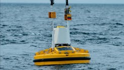
The idea behind the research project is to create a fiber-optic network linking dozens of seabed nodes. Each node would hold multiple sensors for long-term monitoring of the biological, chemical, and physical properties of the seabed environment.
The seabed monitoring off Vancouver Island, being conducted by the University of Victoria, will be followed by a pilot project in Monterey Bay, California. These installations are part of a larger regional observatory called Neptune that will be built by the National Science Foundation. Marine resear-chers envision a communication grid with Internet links, so that anyone with a computer could work with the data flowing from the sensor net.
Cretaceous sea level rise
Cores drilled from the New Jersey coastal plain found that ice sheets likely caused massive sea level change during the Late Cretaceous – an interval previously thought to be ice-free. Led by Kenneth G. Miller of Rutgers, The State University of New Jersey, scientists examined cores from ODP Leg 174AX, an onshore extension of an offshore leg. They found that sea level changes were large (> 25 m) and rapid during the Late Cretaceous. Seismicity, seismic stratigraphy, and sediment-distribution patterns indicate minimal tectonic effects on the New Jersey Coastal Plain during this time. Another explanation for such large, rapid changes is the waxing and waning of continental ice sheets.
"Our studies of cores in New Jersey provide one of the best dated estimates of how fast and how much sea-level changed during the greenhouse world of the Late Creta-ceous," Miller explained. "The Earth was certainly much warmer at that time, probably due to high carbon dioxide levels in the atmosphere. However, at the same time, our estimates require that ice sheets grew and decayed on Antarctica during this period of peak warmth, a previously heretical view."
The propose explanation is that the ice sheets were restricted to Antarctica, ephe-meral, and paced by Milankovitch forcing. The ice sheets would not have reached the Antarctic coast, explaining the relative warmth in Antarctica, but still could significantly alter global sea level. The study results were published in the Geological Society of America Bulletin, March/April issue.
EXPLORATION
Sea of Okhotsk
TGS-Nopec Geophysical Co., in cooperation with Dalmorneftegeophysica (DMNG), will shoot a multi-client 2D seismic survey northeast of Sakhalin Island in the Sea of Okhotsk. The project will gather 9,100 km of data to examine deeper basins immediately east of the island's producing fields and will infill the company's 1998 survey.
TGS-Nopec will shoot 9,100 km of multi-client 2D seismic off Sakhalin Island.
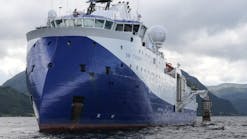
DMNG's M/V Zephyr 1 will acquire the program using a 6,000 m streamer. Data collection will begin in late June with processed data available 4Q 2004.
Qatar 3D4C-OBC
Multiwave Geophysical is completing an ocean bottom cable survey for Occidental Petroleum of Qatar Ltd. in the Persian Gulf. The 250 sq km project is a 3D four-component survey designed to increase production efficiency for the ISND and ISSD fields.
Multiwave began the project in mid-November 2003 and will complete the survey by June. "We rigged our vessels Pacific Titan and Polar King specifically to meet Oxy's needs," said Rick Donoghue, Multiwave's International sales manager. "To do this within just six weeks is possibly a record for a new OBC crew, and is a result of our experience in implementing surveys of this size and complexity."
TECHNOLOGY
3D interpretation
Austin GeoModeling (AGM), in collaboration with Silicon Graphics, has released Recon on the Silicon Graphics Onyx4 UltimateVision visualization system. Recon is a 3D geological interpretation package for visualizing and interpreting well log and seismic data in 3D. It is used for analyzing, modeling, and managing reservoirs.
The software's OpenGL environment combines 3D views of well log and seismic data with basemap and 2D cross-section views. Interpretation changes in any window are immediately reflected in the other two views.
The Onyx4 scales up to 64 CPUs, 128 GB of memory, and 32 graphics pipelines. The CPUs are connected inside a global shared memory to provide a scalable, robust infrastructure. "SGI is pleased to work with AGM to deliver a combined software and hardware solution that can manage the toughest data and modeling challenges the industry can offer," said Bill Bartling, senior director of Market Strategy, Energy for SGI.
Cluster server
Appro International, a developer of high-density, high-performance servers, announced its new 1U and HyperBlade server cluster based on dual-Intel Itanium 2 processors. The cluster offers support for up to 17 compute nodes for a mini-cluster cabinet and up to 80 compute nodes for a full-size cluster cabinet. The company offers cluster management, high-speed interconnect options, and Linux or Windows as operating systems.
Key features include dual Itanium 2 processors, 64-bit computing, support for 16 GB of memory, two internal hard drives, and one 64-bit PCI-X slot per compute node.


