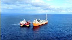
The implementation of seafloor seismic techniques for subsurface imaging continues to grow in popularity, as E&P companies look to recover reserves from areas that present challenges in terms of accessibility or from reservoirs that are difficult to image.
While traditional towed streamer methods continue to be a popular and cheaper means of acquiring seismic data, there are instances in which seafloor technology is ideally suited.
For example, many fields where production infrastructure is already present provide challenges to towed streamer data acquisition because the vessels cannot easily maneuver around the installations or capture data directly above the primary imaging target.
In addition, towed streamers appeared inadequate to address major imaging challenges such as gas clouds and complex, steeply-dipping, subsalt structures. Data from towed streamers is also often degraded somewhat by tow noise from the cables in the water and wave and swell noise.
Seafloor seismic-benefits
Seafloor seismic technology has advantages over traditional towed streamers. Seabed seismic captures full-wave (multi-component) seismic data that delivers broader bandwidth P-wave data for higher resolution images, and converted-wave data to improve reservoir characterization and imaging through gas clouds. The wide azimuth distribution available with seafloor seismic also allows for improved illumination of complex targets, such as subsalt regions. A final key advantage is that seafloor seismic eliminates tow noise from streamer cables in the water, which may distort the image received.
Comparison of seismic imaging data obtained via towed streamer (left) and I/O's seafloor seismic technology (right) at shallow depths.
While many of these advantages have been reported and are well known within the seismic community, there are challenges associated with using seafloor seismic. Most notably, it is difficult to maintain a true vertical sensor orientation with the technology. To get around this challenge, one option is to employ omni-directional geophones. However, while they do not need a true vertical alignment, the quality of the signal received suffers. ROVs may be employed to manually place sensors on the seafloor, which is both time-consuming and expensive.
Input/Output Inc. has reported success in overcoming many of these seafloor seismic challenges with its VectorSeis Ocean (VSO) seabed acquisition system. This technology has been deployed in many well established offshore regions, including the North Sea and the GoM.
VSO is centered on the VectorSeis digital 3C sensor, which records broadband 4C full-wave data with extreme vector fidelity, leading to dramatic increases in the spectral content of the acquired data (at both the low and high ends of the spectrum). VSO uses a unique noise-reducing cable system that decouples the VectorSeis sensors from the cable, while maximizing the coupling of the sensors to the seabed, resulting in improved quality of the acquired seismic data.
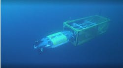
VSO also incorporates buoyed recording technology that allows seismic data to be captured at the ocean’s surface, increasing system availability and reducing the costs of data retrieval compared to traditional systems that require either a dedicated recording vessel or ROVs to access data recorders on the ocean floor.
I/O subsidiary GX Technology designed a series of proprietary and multi-client imaging programs using VSO. Field acquisition was performed by Reservoir eXploration Technology (RXT), a seabed acquisition specialist headquartered in Norway. RXT has developed a proprietary method for deploying VSO which ensures safe, highly productive, and cost-efficient acquisition.
Many of the datasets were then processed using the advanced algorithms and proprietary workflows of GXT. Processing steps included data conditioning, tomographic velocity modeling, wave equation depth migration, and converted wave processing.
The results
Acquired broadband seismic data provides high resolution images down to 70,000 ft. The final images delivered by VSO and GXT reveal features throughout the geologic section that previously could not be seen at all.
In the shallow section, the frequency content of the acquired data is much broader, with quality signal obtained as low as 2Hz and beyond 80Hz. The resulting resolution of the reflection horizons is much improved relative to data acquired with towed streamers or legacy seabed systems. In addition, faults and other structural features are more clearly defined.
Deeper in the section, similar benefits - higher frequency content, improved structural and stratigraphic resolution - are obtained. In a number of instances, deep structures that were previously invisible on earlier sections become clear.
In the ultra-deep case, reflection energy can be seen below 70,000 ft (just above the basement layer). These are of special interest to the oil & gas companies that control the acreage above these zones as they underlie one of the largest deep gas discoveries on the GoM shelf and provide some clues into the migration pathways and depositional history in this area.•


