Wide azimuth gathers better reservoir data
The offshore oil and gas industry cont- inues to have imaging problems around complex structures. This difficulty is due in large measure to the limitations of towed streamer acquisition. To properly image complex features, geoscientists must record the seismic data using a wide variety of source-receiver azimuths, unlike the narrow azimuth of data recorded using conventional towed streamers.
Development teams are also calling on seismic data for more help. Operators want more physically accurate data and want to track fluid movement in reservoirs once production begins. Development teams specifically design plans for the target reservoir, and development costs run into hundreds of millions of dollars. Additionally, development drilling targets are increasingly precise, requiring not only accurate horizontal positioning, but vertical positioning as well. Production facility design errors, either over-building or under-building, can lead to large financial losses that are irrecoverable over the life cycle of the field.
Reservoir size, shape, and characteristics are the key pieces of information required to get the design right. It is the role of the geoscientist to provide this information to the development team, and seismic data is the most important tool that the geoscientist has to derive this information.
The industry needs a new approach to data collection. Currently, towed streamer cables record seismic information. This data is to some extent degraded by:
• Tow noise from the cables in the water
• Wave and swell noise
• Lack of long-offset information; streamer data is typically limited to offsets of less than 6,000 m
• Insufficient illumination due to the narrow azimuth property of towed streamer surveys.
A nodal seabed seismic system can overcome all of the above problems and also provide additional information to the geoscientist that is not available from streamer surveys:
• Converted wave data for use in determining reservoir fluid characteristics (by amplitude comparison with P-wave data and for imaging through gas clouds)
• P-Z summation as a tool for eliminating surface related multiples
• Precise, repeatable positioning that is critical for time-lapse surveys and that is achievable without disturbing production infrastructure.
The most important benefit a nodal system provides is the ability to economically record an all-azimuth survey. The development team requires an all-azimuth illumination to accurately image reservoirs that are partially obscured by salt bodies or other velocity complications.
A look at two pre-stack depth migrated sections illustrates how the choice of shooting direction can affect the image. In the example, an “inline” section from a survey shot north-south shows a good image of sub-salt reflectors but does not show the salt flanks as well as the section on the right. A “crossline” section extracted from a survey shot east-west in the same position as the inline section shows only low amplitude migration artifacts in the circled area of interest, but does show a better image of the salt flanks. Aside from the shooting direction, both sections have identical acquisition and processing parameters.
An all-azimuth survey does a better job of imaging both the reflectors and the salt flank. The all-azimuth survey reduces migration artifacts, bringing out reservoir features such as faults and bed terminations against salt walls. This improvement in image quality not only permits better well planning but also allows a more accurate quantification of reservoir size and shape, thereby improving production from the field.
Since a geoscientist can repeat a nodal survey later, even if additional facilities are installed, this type of seismic acquisition is ideal for 4D applications.
Data processing
The geophysical data processing industry has years of experience working with conventional streamer data and has automated many of the steps in the flow. Broad azimuth data recorded using receivers located on the deep ocean floor is a different type of data that will, in the short term, lead to more time and effort to generate the final image.
Some of the aspects of this type of data that are significantly different from conventional streamer data include:
• P-wave anisotropy, almost always ignored in conventional processing, may have to be accommodated in processing broad azimuth data
•Limited near-surface velocities do not provide good velocity information for areas near the water bottom due to the sparse distribution of receivers. It also complicates the use of conventional surface-related multiple elimination approaches
• Due to large elevation differences between sources and receivers, common reflection points do not approximate common mid points, making impossible the use of conventional “stacking.”
Operations
Fairfield’s new Z-System for gathering nodal data requires two vessels, a pod management vessel (PMV) and a dual-source shooting vessel. The PMV houses the ROV operation along with the battery charging and data transcription facilities. The shooting vessel continuously traverses the survey area, firing its guns to create a grid of shots over the prospect.
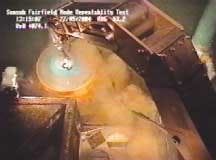
The PMV lays out and “boxes in” acoustic transducers for positioning. After completing this task, one or two ROVs lay out the receiving grid of nodes on the sea floor. LBL acoustics integrated with an inertial guidance system aboard the ROVs control positioning. After a sufficient number of nodes deploy, the source vessel shoots on pre-plotted locations and radios time and position data to the PMV. After completing the initial receiver grid layout, the PMV begins a rotation process, retrieving and laying out new nodes so that battery life is not exceeded. The PMV can deploy, retrieve, or rotate up to 120 nodes per day.
Onboard the PMV, the retrieved nodes recharge and have their data extracted. The extracted data is time corrected and merged with positioning data from the shooting vessel to generate SEG-Y formatted common receiver gathers.
Survey design
Because cables do not constrain the recording system, survey design is highly flexible. Record length can be as long as required and sources can be at any offset or azimuth. The nodal system can be depoloyed and retrieved without disturbing existing production infrastructure.
Nodes are deployed at 400-m intervals and shots at 50-m intervals. All nodes are active for all shots within 10,000 m. The survey records all-azimuth data and has a multiplicity in the central area exceeding 300 fold.
Surveying operations for this nodal survey takes about two months. Firing every 12-14 seconds, a survey consisting of 240,000 shots requires five or six weeks to shoot. Time for initial layout and for final node retrieval adds an additional two or three weeks to the survey.
Because of system flexibility, geoscientists can also record designs using different node or shot densities. Nodes or shots can be optimally located to illuminate features of interest.
Survey cost
A similar size survey using a conventional multi-streamer vessel takes about three weeks. Since the operational day rates for a Z-System crew and a conventional streamer crew are comparable, the acquisition cost of the sea floor node survey is about two to three times that of the streamer survey, on a per-square-kilometer basis.
However, to approximate the multi-azimuth benefits of the node survey, the streamer survey has to be shot at least three times in different orientations. Additionally, only the largest streamer vessels are capable of recording data with offsets as long as 9 km. Using a conventional streamer vessel, it would not be possible to achieve the long offset and multi-azimuth benefits of the nodal survey for the same cost. The streamer survey would not record multi-component data and would be subject to surface and tow noise problems as well position repeatability issues.
4D applications
One- or two-block nodal surveys would cost less than 15% of that of a permanently installed seismic monitoring system. For 4D studies of 10 or fewer surveys, repeat surveys using a nodal system would be cheaper than a permanent installation. Additionally, using repeat surveys removes the risk of a permanent system degrading over time. The system is deployable over fields with existing infrastructure.
Fairfield Industries developed a new nodal seismic system over the past three years. The Z-System uses fully autonomous nodes on the seafloor that continuously record four-component seismic data for periods of up to four weeks in water depths to 3,000 m. Internal components include batteries, a precision clock, flash memory, a magnetic compass, and a 24-bit converter. Aside from geophone coils, there are no moving parts or external connecting cables in the nodes. All components operate in a pressure-protected environment. The first Z-Pod crew will be operating in the Gulf of Mexico in summer 2005.null


