EQUIPMENT/ENGINEERING: Higher signal-to-noise ratio yields higher resolution for high-density 3D
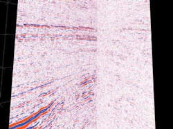
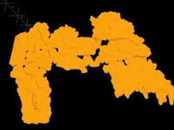
Single source data (left) acquired and processed in 2000/2001, compared to corresponding dual source data (right) acquired and processed in 1999.
During the last decade, the oil and gas industry experienced severe pressure to increase efficiency and reduce cost. Although efficiency has been greatly improved in the seismic industry, acquisition configurations typically deployed are still driven by cost, sometimes at the expense of data quality.
The increase in streamer towing capabilities and the large channel counts deployed on land and seafloor make it possible for the first time to deliver 3D seismic data with high fold and dense spatial sampling, while maintaining record levels of efficiency.
High density 3D, HD3Dtrademark, is technology designed by PGS to allow 3D data to be acquired with significantly higher trace density and crew efficiency than the industry standard. Typically, marine seismic surveys are acquired with 100-meter separation between the cables using two seismic sources (dual source) resulting in a subsurface definition of 6.25 meters by 25 meters (bin size) in the in-line and cross-line direction, respectively.
In the marine environment, it is possible to deliver single source acquisition, resulting in a 40% improvement in signal-to-noise ratio, with close to the same efficiency as industry standard dual source acquisition. Furthermore, the very high number of streamers deployed simultaneously in the water makes it feasible to acquire data with bin sizes as small as 6.25 meters by 6.25 meters, while maintaining high efficiency.
Conventional seafloor seismic surveys are often acquired with 25 meters inline and 25 meters to 50 meters cross-line bins. Fold typically ranges from 40 meters to 60 meters. Using multi-receiver line patch survey designs, HD3D seafloor seismic data can be acquired with 12.5 meters by 25 meters bins, nominal fold of 300 or more, and uniform azimuth distribution.
Due to the high fold and dense spatial sampling HD3D technology improves many of the necessary steps in data processing such as velocity determination, multiple removal, noise attenuation and static solutions. Pre-stack analyses like AVO (amplitude versus offset) and AVA (amplitude versus azimuth) are improved by the enhanced spatial and azimuth sampling and the greater trace densities. The data are very well conditioned for applications within 4D seismic.
Streamer HD3D
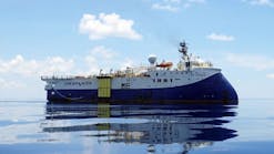
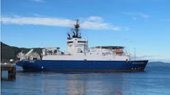
Recently, the PGS Ramform Victory completed the industry's first single source, 16-streamer survey in the Flotta Catchman Area (FCA) of the UK North Sea for Talisman Energy (UK) Limited. The vessel successfully completed more than 2,500 sq km of acquisition using sixteen 4.5 km streamers separated by 50 meters.
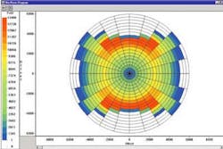
Seafloor HD3D survey rose diagram showing well sampled azimuth distribution.
Over the last decade, the increase in surveying efficiency of the marine seismic industry was achieved through developing the ability to tow many cables with large separation between the streamers. This reduced the number of passes the seismic vessel had to traverse over the survey area. Success-fully deploying 16 streamers (separ- ated by 50 meters), demonstrates the ability to acquire single source data with close to the same efficiency as industry standard dual source acquisition.
In a single source acquisition, each sub-surface reflection point is illuminated twice as much as a corresponding dual source survey. This results in an improved signal-to-noise ratio of 40%. This can be seen in the data comparison between a recently acquired dual source survey (45 fold) and a single source survey (102 fold) overlapping the existing dual source data (Eng, 2001).
While single source acquisition may produce superior data in areas with poor signal-to-noise ratio, the requirements for fold and spatial sampling may vary, depending on geology and target depth. The recent 16-streamer deployment verified that bin sizes of 6.25 meters by 12.5 meters can be achieved very efficiently. Furthermore, recent field trials conducted by PGS confirm the ability to tow a large number of streamers separated by 25 meters and thus deliver uniformly sampled 3D data with bin sizes as small as 6.25 meters by 6.25 meters.
Seafloor HD3D
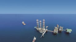
With the trend toward exploitation of existing assets and exploration over areas with complex reservoirs, the HD3D concept is desirable and now applicable to seafloor seismic acquisition. The latest example of this is a 1,500 sq km survey being conducted by PGS over a giant offshore oil and gas field in the Emirate of Abu Dhabi, UAE (Ajlani, Ebed, Suwaina, Al-Kaabi, AL Shamsi & Hall, 2001).
For ongoing reservoir management needs, objectives of the survey included the ability:
- To detect faults with more than 4-6 meters of throw
- To identify the density and direction of fracture zones
- To identify the distribution of stylolitic zones
- To identify the porosity distribution with reservoirs more than six meters in thickness.
A secondary objective was to provide a base survey for future 4D seismic, i.e. 3D time-lapse seismic studies. To meet these reservoir objectives, the survey was designed to provide high spatial sampling, high fold, and a wider distribution of offsets and azimuths than found in a conventional seafloor survey.
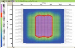
A six-receiver line patch design was used. With patch designs, output bins of 12.5 meters by 25 meters can be achieved, with a high nominal fold. These designs also provide wide-azimuth coverage, sampling all azimuths equally well.
Imaging data
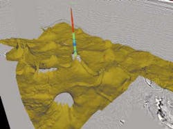
The holoSeis system was used to quality control a 6,000 sq km data set acquired in the North Sea.
The greatly increased trace density and corresponding increase in 3D data volume require visualization technology that can handle very large data sets. With the increase in data volume, it is important that data quality control (QC) be carried out efficiently throughout data acquisition and processing.
Today's applications on the market all rely on loading all the data into main memory. This is a major restriction upon the size of the data volume that can be visualized. To overcome this, PGS developed holoSeistrademark without this restriction. The problem is solved by fast disk-caching. This allows visualization of data volumes that are up to 20 times larger than the computer's main memory. This technology is used for QC purposes during both acquisition and processing. (Lima, 2000).
The use of advanced visualization technology in data interpretation has resulted in significant reduction in the required resources and time to interpret and generate earth models from 3D seismic data. The new imaging system uses advanced automated horizon building technology that allows earth models to be generated very fast even on large data sets.
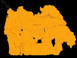
However, the results from automated routines for model building depends on the quality of the seismic data. Due to the significantly better signal-to-noise ratio in the single source data, the automated horizon builder works much more effectively on the single source data set.
High density 3D seismic consisting of high fold and/or smaller bin sizes is ideally suited for use in high-end visualization systems due to the higher signal-to-noise ratio and improved resolution, yielding better accuracy and faster interpretation.
Conclusions
HD3D technology has been introduced for land, streamer, and seafloor acquisition systems. Significant developments in towing and handling systems for marine seismic acquisition, as well as corresponding equipment and recording improvements for land seismic acquisition, made the introduction of HD3D possible.
Efficient quality control through acquisition and processing is made possible by the holoSeis visualization technology, developed specifically to handle very large data sets. HD3D technology produces 3D seismic data with significantly higher trace density and efficiency than industry standard, with improvements in both signal-to-noise ratio and resolution. HD3D expands both the life-time and usability of 3D seismic data and makes the data particularly well suited for use in reservoir characterization and 4D seismic studies.
References
Eng, R., 2001, New acquisition methods yield 3D seismic improvements: Offshore March 2001.
Lima, J., 2000, Using VR tools to quality control seismic acquisition surveys: Offshore August 2000.
Ajlani, G., Ebed, A. Suwaina, O., Al-Kaabi, M., Shamsi, A., Hall, M., 2001, Visco-Elastic modeling, 3D DMO bin simulation and multidisciplinary 2D/3D OB design analysis for reservoir characterization of an offshore carbonate field in Abu Dhabi, UAE: 1st International Seminar on Seismic for Enhanced Reservoir Characterization

