David Equid - Gorgon Project
Large diameter, deepwater pipelines are a significant part of total project cost, so optimizing routes was required from both installation and operations cost viewpoints for both the Gorgon and deepwater Jansz fields off the northwest coast of Barrow Island, Western Australia. Routing the pipelines between Jansz and the onshore LNG facilities was a challenge because of the 1,350 m (4,429 ft) water depth and the need to avoid debris fields. Traversing the scarp on the way to shallow water and the shore crossing at Barrow Island turned out to be the most challenging.
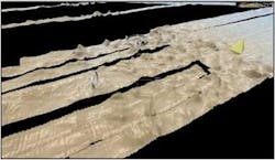
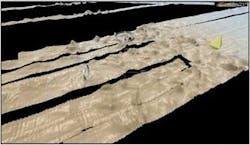
Early in FEED, analysis of seismic records from the exploration phase identified significant seabed irregularities at Jansz, massive blocks left as a debris field following a catastrophic failure of the scarp closer to the island. This raised concerns with stability in sections of the scarp and exposure of the pipeline to damage following any failure.
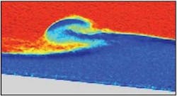
Soliton (internal) waves that periodically occur on the North West Shelf affect both pipeline installation and the stability of completed pipelines. Little was known of Solitons along the proposed pipeline route. Initiating events and the peak magnitude of the currents associated with breaking Solitons were not well known. Offshore data collection by the project combined with extensive modeling reduced the uncertainty surrounding these events to an acceptable level.
The ability to transport the liquids and fines associated with production from Jansz up the potentially steep inclines along some sections of the scarp was unknown. No dependable way to predict this flow within the inclined sections was known.
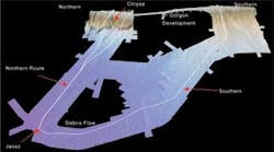
Finding a viable route to address these obstacles was a challenge, but one was found -- the 170 km (106 mi) “southern” route.
A shorter, more cost effective “northern” route had been identified but this would require crossing the scarp in an area with slopes up to 70º. Analysis of survey data combined with detailed modeling confirmed that the scarp was geologically stable in this location, and further work using both analysis and modeling determined that the fines and liquids from Jansz would flow up the inclined pipe along with the gas.
The final selection of an optimized “northern” route represented not only a viable solution to the routing question but also realized significant cost savings relative to the initial concepts.
Route selection
The development concept for Jansz is based on an all subsea, full wellstream-to-beach configuration. This selection resulted from initial concept development work by ExxonMobil and was validated independently by Chevron. A revalidation by the project team in 2006 part way through FEED, utilizing more comprehensive design and cost data, confirmed that this was the most cost effective and technically viable basis for joint development of Jansz and Gorgon fields.
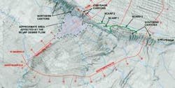
To connect the LNG plant on Barrow Island to the deepwater Jansz location, the pipelines need to transition from 1,350 m (4,429 ft) up onto the continental shelf at maximum depths of about 250 m (820 ft) across an underwater scarp. Prior seabed surveys by Gorgon Joint Venture members showed that the scarp on the direct route to Jansz had slopes of up to 70º. In addition, early work indicated the scarp might be unstable in these regions, especially in the area around the Chrysaor canyons where active movement of seabed material had been noted.
To avoid these features, a longer southern route that did not cross the steep sections of the scarp was identified. It added 45 km (71 mi) to the length of the direct route. The lower angled slopes along the southern route were not considered to be flow assurance issues
An extensive geophysical and geotechnical survey in 2005/6, gathered data along potential pipeline routes, scarp crossing, and subsea structure locations. This survey was managed by Chevron, supported by technical specialists from ExxonMobil. Approximately 5,550 km (3,449 mi) of survey lines including 2,500 km (1,553 mi) of deepwater reconnaissance, 2,200 km (1,367 mi) of detailed deepwater survey, and 100 large gravity piston cores and boreholes were involved.
Data confirmed the validity of the southern route and also helped identify shorter northern routes. Detailed seabed profile assessments along the routes, pipeline mechanical design, installation analysis, and geohazard modeling based on results from geophysical data and core analysis (palaeo age dating) were conducted for each potential route to Barrow Island.
In parallel with the seabed survey, a separate program collected metocean data along potential pipeline routes. Soliton waves, a tidal current phenomenon in the North West Shelf at the boundary between warm and cooler streams could pose issues during the installation and operation of the pipelines. The 12 months of data collected was combined with approximately three years of prior data as the basis for building models to predict local seabed currents as input to the pipeline stability analysis. This data was the basis of the project’s contribution to the Northern Australia Soliton Study (NASS) Joint Industry Project, which developed a model to predict Soliton waves – likely sources, direction, and magnitude – along proposed routes.
The conclusion from the NASS work was that due to the obtuse angles at which tides approach the Jansz/Gorgon area, their Soliton generating effects are not as great as those at Rankin, for instance, where the tides arrive perpendicular to the bathymetry. The 10-year return period Solitons were determined to not exceed the 10-year non-cyclonic design criteria, nor are the 100-year return period Solitons expected to govern the stabilization design.
By 2006 work had confirmed viability of the southern route. The project team confirmed a successful installation could be done, taking account of pipeline design and geo hazard risks, and this southern route formed the basis for the initial round of project cost estimates. Focus then turned towards route optimization and identification of northern route alternatives. A route passing just north of Gorgon was developed that used a section of the scarp where the maximum inclination is approximately 70º and the scarp or cliff height about 100 m (328 ft).
Alternate route development
Northern routes had challenges related to:
- Transport of well fines up steep inclined pipelines
- Long term acceptability of any resultant “super spans”
- Ability to pre-trench the top of the scarp to reduce the span length.
The costs for any remedial work (such as routine pigging during operation) might negate the initial cost savings of the shorter pipeline.
A two-stage program evaluated the transport of expected fines production from Jansz up the inclined section of pipe at the scarp crossing. Numerical analysis combined with physical model testing coordinated by Chevron demonstrated with high confidence that within the expected range of flowrates in the lines, the predicted sizes of fines will be transported through the deepwater pipeline section and up the scarp. The effect of the differing slopes between the identified northern and base case southern routes was insignificant.
The pipeline design team evaluated the predicted span at the scarp crossings. To reduce span length it was proposed that a trench be cut at the scarp shoulder, adjusting the exit angle of the pipeline and effectively reducing the height and length of the resulting span. The construction of a trench through the over consolidated calcareous soils at the scarp required detailed assessment, as this soil has very different characteristics to usual deepwater soils. Laboratory testing of samples collected at the scarp, combined with site specific offshore geophysical and geotechnical investigations, confirmed the soils are trenchable.
This investigation and evaluation resulted in a number of feasible design options. The new analysis processes applied to the different sections of line, including the portion where the crossing of the scarp occurs, resulted in the selection of the northern route as the basis for the project. This routing realized installation cost savings as well as improvements in the operability of the overall subsea system due to the shorter pipeline lengths and the associated reduction in flow-related back pressure on the wells.
The Jansz-Io feature was identified during the 1996 North West Shelf offshore acreage gazettal, delineated in a 2D seismic program in 1997, and confirmed by the Jansz-1 exploration well in 2000. A second well, Io-1 was drilled into the same feature in 2001. Further wells, Jansz-2 and Jansz-3, were drilled in 2002 and 2003, respectively, and a detailed 3D seismic survey acquired over the area in 2004. This exploration sequence confirmed the presence of a world class gas resource.
In January 2004, a Cooperative Development study by ExxonMobil and Chevron evaluated a range of development options for the combination of the Jansz and Gorgon fields, and led to the current project – joint development of the fields based on an all subsea development, tied back via full wellstream pipelines to a multi-train LNG plant on Barrow Island.
Editor’s note: This article is a summary of the paper presented at PennWell’s Deep Offshore Technology International Conference & Exhibition 2008 in Perth, Australia. www.offshore-mag.com.
