Svalbard strata.
- Creation of voxel cube [19,688 bytes]
- Jason's Earth Model shows top of reservoir horizon with gaps repaired and deviated well tracks. [4,691 bytes]
Statoil's synthetic seismic results
A recent study at Statoil's Trondheim research center has produced new insights in seismic interpretation. The seismic imaging of deep marine sediments employs studies of geological formations on the surface to construct synthetic seismic images of similar stratigraphic sequences deep beneath the ocean's floor. The results have been remarkable, producing images that are almost as good as genuine images.Geologist Stâle Johansen and senior geo physicist Espen Granberg found that Norway's far-arctic Svalbard Islands offered surface rock formations that are extensions of strata lying thousands of meters beneath the Norwegian Continental Shelf, with very little surface soil or vegetation to obscure the strata.
Once Statoil's geoscientists completed the mapping of relevant formations on Svalbard, the company's geophysicists converted the geological models to seismic images, providing near perfect synthetic images that enhance knowledge of how different rocks appear in seismic data and models. As a consequence, geophysicists can interpret what they see in the actual deep marine formations more effectively by comparing the synthetic data with the real data.
21st Century seismic vessels
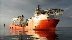
By midyear next year, PGS's fleet of Ramform seismic vessels will have been expanded with the addition of two new vessels, the Ramform Valient and Ramform Viking, and Geco-Prakla's fleet of high tech seismic vessels will have been upgraded to carry wider streamer arrays, among other improvements.Now, however, comes announcement of a new Geco vessel, as yet unnamed, that will pull up to 20 streamers. The vessel, said to be the world's largest, will be 95 meters long, 24 meters wide, and have a delta-shaped back deck 40 meters wide. With a conventional hull, the new ship will look much like the other "Gem" vessels, with the exception of the above-water delta form of the back deck.
Geco says the new vessel will have a streamer spread in excess of 1300 meters, an 80 km streamer capacity, providing cost effective wider tows for exploration 3D and a denser blanket coverage for high resolution 3D. Additionally, the Norwegian-built vessel will have the power to pull very long streamers and maintain stability in rough seas. Its unique cable and towing system features tow points in both the back deck and in mid-ship, with reels in both locations. It is expected to be in service in the first quarter of 1999.
Voxel visualization
CogniSeis, recently acquired by Paradigm Geophysical, is employing volume-based visualization, an advanced 3D imaging technique, to directly identify both structural and stratigraphic targets using the data itself as the model. The entire, raw, uninterpreted volume becomes the model, with horizons, faults, channels, etc. the seismic responses.In voxel visualization systems, each seismic sample corresponds to a voxel element, a 3D pixel with inline, crossline, and sample rate dimensions. Each voxel trace may contain thousands of voxel elements, and each voxel volume may have hundreds of millions of voxels.
In addition to the seismic attribute, each voxel carries an alpha variable which determines its opacity level. A histogram that displays the relative amplitude of all the voxels in the 3D volume may be used as a reference when manipulating opacity.
Using these opacity controls, geoscientists can determine which amplitudes are transparent and which are opaque, depending on objectives, since it is the opacity that distinguishes visualization systems from conventional tools.
Modeling system repairs holes, gaps
Jason Geosystems' new EarthModel system takes horizons and faults from an interpretation package and transforms them into a geologically consistent 3D model by repairing gaps and holes in the interpreted surfaces and by sealing horizons against faults or truncating horizons.The system is able to reconcile sonic logs in depth, including deviated wells, with seismic horizons defined in time to generate a 3D model in depth and/or time. This is achieved via a constrained fitting algorithm that links the available time and depth information, with a smooth, closed layer model suitable for interpretation, mapping, modeling or ray tracing as the result.
Jason does this by utilizing the Stratigraphic Framework Table, wherein the user defines individual layer interactions, including conformable, fault, onlap, offlap, truncation, reef, and channel relationships. Once completed, it can be used to generate output models and synthetic well curves.
PGS taking Australian boom seriously
PGS is taking Western Australia's booming oil and gas business seriously. Not only has the company opened a full service office in Perth for data processing and management, that will include PGS Tensor, Data Management, Ocean Bottom Cable, and Exploration divisions, but the company is bringing its Ramform Explorer to the region for a very large Northwest Shelf spec shoot. The move will follow the vessel's completion of work on Canada's Newfoundland Grand Banks. Martin Bawden is the new manager and Terry Allen, previously with Western Geophysical, is the new regional geophysicist.Diamond commences US Gulf survey
Diamond Geophysical secured sufficient precommitment funding to undertake acquisition of 3D data over an 85-block Gulf of Mexico Mississippi Canyon/Atwater Valley Phase 1 area to begin shooting in August. It expects the data to be ready in time for the March lease sale. Additionally, the company has begun a multi-client 3D prestack depth migration project in Vermilion South, South Marsh Island South, and Grand Isle South.Copyright 1997 Oil & Gas Journal. All Rights Reserved.


