The continuing trend of major discoveries in the deepwater Gulf of Mexico has rejuvenated the US oil and gas industry. However, with this new frontier comes new challenges. One of those challenges lies in the surface location of wells and development facilities.
Hazard evaluation techniques, which were originally developed for the shallow water shelf, are inadequate for proper imaging of the deepwater seafloor and near surface. The development of new techniques and the updated application of existing technology have provided the tools needed to fill this void to adequately evaluate the potential for hazards.
Amerada Hess (AHC) recognized early the need for thorough hazard evaluation using the latest available technology. After a significant discovery was made in 1991 by the AHC Garden Banks Block 260 Well No. 1, efforts were initiated to delineate and identify the optimum surface location for a potential development production 120 miles off Louisiana in about 1,650 ft water depth.
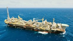
A location had to be identified which would support a 40,000-ton platform and drilling rig with minimal risk of seafloor instability. This was extremely critical, as this new innovative "compliant" platform structure was to be the tallest freestanding structure in the world. Due to the estimated $300 million dollar cost associated with this facility and the ensuing development, a rigorous evaluation was initiated. Multiple data sets were acquired, interpreted, and incorporated into the evaluation to provide an adequate analysis of ocean bottom conditions.
The initial exploration well was drilled utilizing the original 1985 hazard data. Interpretation of this shallow tow hazard data indicated significant surface faulting and near-surface zones of acoustic wipeout. Due to the inability of this data set to adequately image and clearly resolve features across the Baldpate Project (Garden Banks 260/259), where water depths ranged from 900 ft to 1,800 ft, additional technology was needed.
Geohazards identified by sidescan radar imaging included this mud volcano and adjacent carbonate hardground.
Deep tow resolution
In 1992, Amerada Hess contracted a relatively new deep tow system to acquire a state-of-the-art hazard survey with a sub-bottom profiler and sidescan sonar. This deep tow system utilized a much longer tow cable than the conventional shallow tow systems. The long cable, combined with a carefully balanced buoyancy system, enabled the recording instruments to maintain to a relatively constant depth of 90 ft above the seafloor regardless of varying topographic features.
With a longer tow cable, navigational tracking of the tow fish was accomplished using satellite telemetry into a transponder array set on the ocean floor. Additionally, while the original 1985 data set was acquired with traditional line orientation paralleling the block lines, the new survey was rotated 60° to optimize the ability to image the apparent NW-SE trending en-echelon surface faulting pattern. A future enhancement was the acquisition of a tighter data grid over potential platform locations, which were pre-selected from the original shallow tow data.
Upon interpretation, the data quality and image-ability were found to be tremendously improved. Resolution of surface and near-surface features allowed for more detailed mapping. The final interpretation indicated a much more complex set of ocean bottom conditions. Surface and near-surface acoustic wipeout zones were present close to potential alternative platform locations, and possibly within the proposed anchor spread of the semisubmersible rig that would conduct the development drilling. Within this water depth regime, authegenic carbonates, gas hydrates, and gas seeps are common occurrences and can be the cause of such wipeouts.
Ground truthing
AHC's desire to improve the understanding of the nature and source of these events and their impact on potential development led to the pursuit of methods of "ground truthing" via firsthand visual observation. To this end, AHC contracted the Harbor Branch Oceanographic Institute and utilized the Johnson Sea-Link submersible to conduct a series of dives in and around the Baldpate Project.
Video and still-frame photography, supplemented with push-core and sample acquisition, were gathered and analyzed to determine the nature and severity of surface and near-surface features. The predisposition for mass surface movement, slumping and active surface fault movement were thoroughly investigated as well as the potential presence of chemosynthetic communities which would be affected by potential development locations.
The final platform site permitted a number of drilling options for field development.
Choosing the final site
At the conclusion of the initial evaluation of the Deep Tow Hazard study several alternate potential platform sites were identified. Through the ground truthing and seismic integration process, a final optimum site was selected which allowed the potential anchor pattern of the semisubmersible to "snuggle" very close to transitional hardbottom areas.
These were deemed to contain only sparse isolated hardbottom features and to completely avoid the problematic continuous hardbottom areas. The result allowed directional development wells be designed and drilled such that through salt penetration and long reach long measured depth directional wells could be eliminate. The result was the saving of millions of development drilling dollars.
During the platform selection process, potential pipeline routes were also investigated. On the mobilization in and out of the Baldpate area, a very sparse number of deep tow hazard lines were acquired without the benefit of the detailed transponder satellite telemetry system utilized over the key Garden Banks Blocks 259/260.
Interpretation of these "recon" hazard lines acquired as part of the 1992 deep tow survey highlighted a suitable potential pipeline corridor from the Baldpate project to the preferred tie-in host platforms. However, due to the sparse grid of data, significant gaps existed over key areas. A cost-effective method was needed to infill the data gaps to fully evaluate regional seafloor topography in order to optimize pipeline planning.
A new solution
Investigations into the workstation utilization of the conventional 3D seismic provided the solution. Remarkable duplication of detailed hazard data mapping was possible in areas greater than 500 ft water depth. The images of the seafloor, provided by standard computer map analysis (dip, azimuth, and others) of the 3D-seafloor horizon, were striking in detail, yet provided complete virtually seamless coverage over extensive areas.
Faults and drainage features with 5 ft of displacement which had been mapped on the high resolution deep tow survey were also identified on the 3D seafloor images generated from conventional contractor data with no high resolution reprocessing. The incorporation of this data in both the sparse data areas as well as within the detailed key Garden Banks blocks provided for an even higher confidence interpretation.
After rigorous analysis on subsequent projects, AHC has begun to routinely incorporate 3D seismic to provide ocean bottom and hazard analysis in all phases of project evaluation from the exploration drilling phase through project exploitation and development.
The need for additional submersible work has been minimized using the knowledge base built from the integration of first hand observation (of the nature of various events) to the hazard and seismic data expressions,. Fortuitously, as Amerada Hess pushes exploration efforts in the Gulf of Mexico and worldwide into significantly deeper waters and beyond the limits of most manned submersibles, the ability of seismic data imaging is improved.


