From swamps to fast currents
William FurlowChevron's proposed gas export pipeline from Papua New Guinea (PNG) to Australia faces shallow waters, shipping lanes, heavy currents, and a scoured bottom. Still, Richard Heard, Lead Marine Pipeline Engineer, believes the 2,600-km pipeline can be laid in a year's time.
Technology Editor
The marine pipeline component of the project consists of a 76-km-long pipeline from a landfall in the Omati River in PNG, exporting raw gas from the highlands of PNG to a gas processing facility in the Gulf of Papua. The sales quality gas from the facility is exported via a 403-km pipeline across the southern Gulf of Papua and Torres Strait to a landfall on the tip of Australia's Cape York peninsula.
Although Chevron has installed a single oil pipeline in the Gulf of Papua, Heard said, no oil and gas infrastructure exists in Torres Strait. The amount of high quality oceanographic, geophysical, and geotechnical data is very limited for this area.
The Torres Strait has a special environmental designation as a protected zone (Torres Strait Protected Zone) which allows the indigenous population on both sides to freely move within the area and carry out traditional fishing and gathering activities. Commercial fishing is carefully managed within the zone.
Pipeline under river
About 25 km of the pipeline will be installed in the Omati River which, has a 3-4 meter tidal range. Because the water is shallow, it is impossible in some areas to operate a pipelay barge at low tide. Heard said once a day the tide goes out so far that the barge would be sitting on the river bed. Only when the tide comes back in, and the barge is once again afloat, can work continue.The river bed, delta, and the seabed out to the depth of the platform are made up of "mobile" or soft sediments. Such sediments cause anchor-holding problems for a pipelay barge. Heard said there also may be a problem with the soil being too weak to hold the pipeline in place.
Mobile sediments can be scoured, or eroded from around the pipeline over time, leaving it exposed. From the difficult pipelay up the river, the pipeline makes landfall in the swamplands of PNG. Heard said this environment also is challenging, but not unique.
At the mouth of the river, Heard said, there is a brown slick in the water that is visible from the air. The slick extends out 200 meters from the mouth of the river into the sea. He said this slick illustrates how far the mobile sediments churn into the sea. As the slick dissipates, the sediments are deposited onto the river delta and seafloor, causing further problems for the pipeline.
Because the pipeline will be moving through a wide river delta it has to pass through brackish waters that make the transition from fresh to saltwater. Designing a cathodic protection system for this line was one of the technical challenges faced on this project. At the river mouth, the pipeline will most likely receive sacrificial anodes, which will be replaced with impressed current systems to provide protection further up river in the fresh water. This technique of running currents through the steel is typically seen in onshore applications.
Separation facility
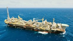
About 50 km from the mouth of the river, the pipeline will tie-in to a processing platform. Currently, the platform is used with a single point mooring for offloading oil from the highlands of PNG. Heard said current plans call for the installation of either a concrete gravity structure or a floating production, storage, and offloading vessel adjacent to the existing terminal.Raw gas will be piped from the highlands to the processing facility where it will be separated into sales gas that will be exported to Queensland, Australia. The LNGs will be transported by tanker to other markets.
The gas export pipeline runs from the separation facility 403 km to the tip of Cape York, Australia. This leg is the most technically challenging portion of the offshore pipeline. The water depth through most of the Torres Strait ranges from 10 meters to 20 meters. The area is the main shipping channel, with a recommended maximum draft of 12.2 meters. Up to 10 vessels per day enter the Strait, Heard pointed out. These tankers range in size from 10,000 tons up to 80,000 tons. "We cannot reduce the water depth in any way," Heard claimed.
The seabed is relatively flat, but the strait is located between the Coral Sea to the west and the Arafura Sea to the east. Tidal levels in these two water bodies are out of sync, causing swift currents flows through the Strait. The pipeline will need to be buried below the seabed, then covered with rock to protect it against the extreme currents that run through the strait. Heard said the currents are 1.75 meters/sec at the pipeline depth on spring tide.
The seafloor is covered with soft sediment, but Heard said he does not know how deep the sediment is. He said it may be possible to jet holes through this sediment to bury some of the pipe, but other areas where the sediment runs thin might require more expensive methods. It might be necessary to plow a trench for the pipeline or hire a suction dredge.
In areas where all the sediment has been scoured away by currents, Heard said it will be necessary to dig a trench and bury the pipeline under a rock dump or use rock bolting to hold it in place.
"This will be resolved during the marine survey," he said. This survey is due to take place after October of this year. The delay is caused by the southeast trade winds, which blow almost constantly between the months of April and October. These conditions make a survey difficult to conduct.
Heavy traffic
The busy shipping channel where the pipe needs to be laid presents a series of problems. During the construction phase the pipelay vessel must schedule work around the vessels moving through the area. Once the pipe is laid, it must be protected from the anchors of vessels waiting for the high tides that allow passage through the Strait. The pipe must be laid in an area where anchoring is uncommon and must be well marked so it will not be interfered with.To get a clear idea on where the highest currents are, Heard said the company will perform extensive tidal modeling. These models, based on current measurements in the area, will help in choosing a pipelay route though the lightest currents.
The Strait is populated with reefs and small islands, which means that no matter where the pipeline is located, it will encounter moderately high currents. Heard estimates 5% of the route will pass through very high current areas, while another 30% of the route will pass through moderately high currents that will require trenching.
Heard estimates the construction of the pipeline will take about 12 months, with 2-4 km of offshore pipe being laid per day. Work is scheduled to begin in the year 2000.
Copyright 1998 Oil & Gas Journal. All Rights Reserved.
