'Birds' to fly no more
David A. Kitchin
The Johns Hopkins University
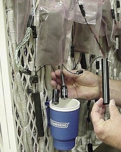
For years, the geophysical industry has used expensive "birds," attached to its towed acoustic streamers, for maintain-ing depth, measuring depth and mag-netic heading, and determining the slant range to other birds and reference points. Although these functions have been combined in a multi-function bird, they are incremental and do not change the way the industry does business, improves products, or reduces costs. Recent innovations by the US Navy have the potential to benefit all of these areas.
null
null
Using a number of new technologies in concert, the Navy has done away with the need for birds in its multi-line systems – with implications that are profound for the geophysical industry. No longer needed are the "aviaries" full of birds; hours of work attaching and detaching them from streamers, slowed deployment and recovery operations, replace- ment of batteries every few days (for older models), and – most dangerous of all – personnel sent out in small boats to untangle streamers when they become hopelessly crossed.
To understand what the Navy has done and why requires an explanation of some recent technological advances:
- Through testing in acoustic tank facilities, the Navy learned that the "stuff" that normally fills an acoustic streamer (the hydrophones, wire bundles, connectors, and bulkheads) becomes acoustically transparent below roughly 20 kHz and does not reflect sound at those frequencies. Trans-ducers working at these frequencies can all be located inside the streamer. (This explains why the transducers in ranging birds, which work at much higher frequencies, are located outside – to get a free field of view side to side and fore to aft.)
- Some niche electronics companies started making high-voltage DC/DC power converters and operational amplifiers, which allow acoustic transducers to be connected directly to the amplifier electronics without going through a transformer. This development permits operation at any frequency within the voltage range of the amplifier and transducer on or off resonance
- The Navy noticed that dolphins and whales are able to echo-locate small objects without transmitting at high frequencies, whereas most commercial systems use frequencies of 50 to 100 kHz to precisely locate objects. These animals are able to use lower frequencies by employing smarter waveforms, like chirps, and smarter processing, like correlation
- Operating at least a decade below resonance was found to move candidate waveforms away from a region of high phase- response uncertainty (located near resonance) caused by transducer tolerance issues inherent in the fabrication processes. Because techniques like correlation are highly sensitive to phase, this discovery was critical to obtaining improved accuracy and repeatability. Although operating off resonance loses some source level, nearly all of it is regained as reduced transmission loss due to the significant reduction in the attenuation factor. (This term in the passive sonar equation increases with the square of frequency, e.g., a32 dB/km at 100 kHz versus a1/2 dB/km at 10 kHz.)
- Recent advances in low-power electronics, miniature sensors, and microcomputer technology have allowed straightforward waveform generation, data acquisition, and real-time or near-real-time processing.
The Navy innovations have achieved other benefits. Without noisy mechanical coupling collars every few hundred meters, Navy streamers need less acoustic energy to detect ranging chirps or other signals of interest. Lacking protrusions, the streamers rarely tangle. By using smarter waveforms and processing, the technology has leapfrogged the accuracy of today's geophysical ranging systems, obtaining ±1-in resolution on a system operating below 8 kHz and ±1-cm resolution on a system operating below 20 kHz. (Typical ranging bird specifications cite ±6 in to ±1 ft resolution.) Combined with higher sensor and transducer densities along each streamer, real-time acoustic Doppler current profiler data, and advanced "water-pulley" multi-line array-shape modeling techniques, these developments have yielded real-time node relative position accuracy performance not yet attain-ed or even envisioned in the geophysical industry with its full acoustic cross-bracing techniques.
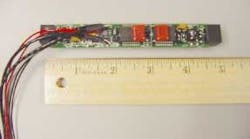
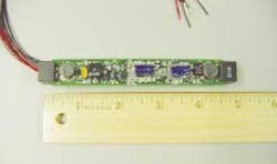
Surprisingly, the cost per sensor or ranging station is also lower than using birds, because only a small circuit board and transducer are added to select module couplings. The Navy's approach was developed through three generations of refinements (the latter two generations are in production on large- and small-diameter surveillance arrays, respectively) and is compatible with either oil-filled or solid-filled streamer technology.
Superb relative position accuracy, although adequate for an initial seismic survey of a new area, is inadequate in and of itself for applications like time-lapse reservoir monitoring (4D seismic) without absolute position accuracy. To enable examination of differences between successive surveys, the array must trace the same track as closely as possible, which requires high absolute position accuracy.
null
Knowing the relative positions of each hydrophone and source to within tenths of a meter is of no value if we don't know the positions of the array's geodetic reference points to any better than 1.3 m. Fortunately, both the Federal Aviation Administration and the Department of Transportation are collaborating with commercial and government-funded research facilities to improve the absolute accuracy of global positioning system (GPS) civilian applications for dynamic platforms. Wide-area differential GPS techniques can achieve accuracy to ≤ 0.3 m, but a local base station (mounted on a fixed or constrained floating structure, for example) allows even greater accuracy – to ≤ 0.1 m.
Redesign of the geodetic reference points may be needed to realize these accuracies. A cursory look at the several tail buoy designs in use shows that little thought has been given to minimizing the motion of the GPS antenna. The GPS antenna should be located at the buoy's meta-center (its center of rotation), so that it sees predominantly linear motion, as opposed to wave-induced motion, and is as high as possible for a clear view to the horizon. Wave-piercing small wetted area twin hull (SWATH) designs and other high-tech approaches may achieve these sometimes mutually exclusive requirements.
Combining these improvements to both relative and absolute accuracy with ongoing developments in seismic data-processing techniques yields numbers like those shown in the table. This means that geological features can now be examined with 20/20 vision rather than through a blurred lens. The key is to understand and eliminate the second- and third-order blurring/noise effects that the industry has lived with for years.
For information, contact Jim Harward, at [email protected] or Gene Olsen at [email protected].
