Northern Gulf of Mexico salt provinces profiled
Andrew Mehlhop
Anadarko Canada Corp.
PART II: This is the final part of a two-part series on salt tectonic style classification as an aid to exploration.
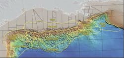
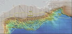
The northern Gulf of Mexico is subdi-vided into nine regional salt provinces. Each province exhibits a unique set of structural and stratigraphic charact-eristics that define their lateral distri-bution. Part one of this article discussed basic criteria that define why certain provinces are more attractive for deep exploration. The most important controls on deep exploration risk within each salt province include:
- Determining whether a province is sediment-dominated (low-risk) or salt-dominated (high-risk)
- Determining whether a province is a single-tiered salt system (low-risk) or a multi-tiered salt system (high-risk)
- Determining the relationship between the timing of salt canopy emplacement and the lateral distribution of deltaic avulsion patterns on a regional scale (sand prediction).
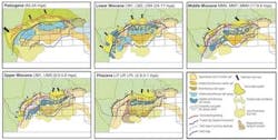
Stratigraphic objectives, structural play-types, and salt evolution for each tectono-stratigraphic province are presented with an emphasis on subsalt and deep gas exploration.
Shelf province
The shelf province is a sediment-dominated, multi-tiered salt system with Lower and Middle Miocene slope channel levee sands as deep drilling targets. Total salt thickness is far exceeded by the total sediment load through time; therefore, the shelf is characterized as a mature system. The mother salt is completely evacuated. The first tier canopy was emplaced during the Paleogene, but is now completely evacuated, leaving remnant diapirs at equilibrium with surrounding sediments. The remnant diapirs are commonly rooted to deep Paleogene weld surfaces rather than autochthonous mother salt.
Internal flow of salt thorough the complex multi-tiered system transports salt southward into the Flextrend Province via first tier canopy evacuation. The entire shelf system is buried by Plio-Pleistocene prograding deltaic sequences.
The primary risk for the deep gas and subsalt play on the shelf is sand distribution. Lower Miocene deep drilling targets are dominantly slope channel levee sands. Additionally, the Middle Miocene staging area shifted eastward toward Mississippi Canyon, leaving most of the shelf out of the primary Middle Miocene sand fairways.
The nature of multi-tiered salt systems suggests that there is no relationship of deep structures to basement controls. Deep structures lie upon allochthonous weld surfaces; therefore, dominant trap styles depend on the nature of salt withdrawal on the deep weld surfaces, i.e., stepped counter-regional and roho style salt evacuation and associated structures. Complete salt withdrawal enhances possible turtle structure formation; however, down-slope salt translation generally inhibits turtles.
null
Flextrend province
The Flextrend is a balanced, multi-tiered allochthonous salt system with Middle Miocene channel-levee and isolated sheet sands as deep objectives. The mother salt is completely evacuated. The Lower Miocene first-tier canopy is mostly evacuated. The shallowest, Lower Pliocene second-tier canopy is at equilibrium with sediments as partially inflated and partially deflated tabular salt. Deep welds are dominantly evacuated, but shallow salt canopies are relatively thick and tabular. The landward portion of this province is dominantly evacuated, while the toe of the province is dominantly inflated. These tabular salt canopies are buried under Pleistocene deltaic sequences and were the early site for subsalt exploration in the northern Gulf of Mexico.
The primary risk for subsalt and deep exploration in the Flextrend is sand distribution, as evidenced by the numerous subsalt wells in this province. Subsalt field sizes are generally limited by sand distribution due to Upper Miocene objectives dominantly existing within upper slope channel-levee environments. Deep tests for Middle or Lower Miocene sands may find better, more laterally continuous sheet sands. This multi-tiered subsalt province lies on deep weld surfaces, not on autochthonous salt; therefore, basement has little to no structural influence on subsalt structures.
Subsalt trap styles are dominated by three-way upward flexing closures against base of salt or welds. Larger subsalt fields are located where downward flexing closures are associated with faulting that is vertically linked to underlying salt withdrawal. Few turtles with four-way closures are expected due to abundant basinward translation of salt canopies during withdrawal phases.
Mississippi Canyon
The Mississippi Canyon province is a sediment-dominated, single-tiered allochthonous salt system with strong vertical linkage to the mother salt and basement structure. The mother salt was inflated from Jurassic through Oligocene leading to condensed sections in these sequences. The mother salt selectively deflated during deposition of thick Miocene reservoir sequences. Continual mother salt deflation caused allochthonous salt diapirs to partially coalesce into juvenile canopies during the Pliocene.
The Mississippi Canyon province is a prolific area for large subsalt hydrocarbon accumulations. The Mid-Cretaceous unconformity is commonly recognized on 10-sec seismic records indicating that basement is not as deep as the South Auger province to the west. The total volume of salt is also much less than areas to the west.
Trap styles include pillows, turtles, downward flexing subsalt three-way closures, subsalt fault traps, and onlap traps against salt stems. Subsalt drilling objectives commonly include proven Lower, Middle, and Upper Miocene middle and lower slope amalgamated ponded sheet sands with less abundant channel levee turbidite systems.
null
Eastern Gulf
The Eastern Gulf province is a sediment-dominated, single-tiered allochthonous salt system. The majority of the province is underlain by relatively thin, deflated Jurassic autochthonous salt. The mother salt has gradually deflated through time to form simple autochthonous diapirs that are dominantly buried by Miocene deposition. Inflated allochthonous salt is limited to the northern portion of the province and is also rooted to the mother salt.
The Eastern Gulf province is highly under-explored and is a possible sweet spot for future large field discoveries due to simple large four-way structures, good imaging, and laterally extensive sands. Trap styles include four-way salt-cored anticlines, turtles, fault traps, and on-lap traps against salt diapir flanks and the Florida escarpment. Drilling objectives will encounter Lower and Middle Miocene middle and lower slope amalgamated ponded sheet sands with less abundant channel levee turbidite systems. True basin floor fans exist across the southern margin of this province.
Mississippi Fan Foldbelt
This area is characterized as a balanced, single-tiered allochthonous salt system consisting of coalesced salt canopies that overlay a NE-SW trending subsalt compressional foldbelt system. Mother salt is dominantly evacuated, but not to completion, as it serves as the decollement for the foldbelt. Allochthonous salt is partially inflated/partially deflated and is directly rooted to the mother salt. The mother salt was inflated until Lower Miocene time when it began to deflate due to thick depositional sequences that were deposited during the Miocene.
The fold-thrust belt developed due to down-dip shortening and was most active during the Upper Miocene as a result of depositional thinning over the crest of folds at that time. Continual salt deflation caused allochthonous salt canopies to develop and coalesce over the province during the Pliocene.
The Mississippi Fan Foldbelt is another sweet spot for large fields due to large structures and laterally continuous sheet sands. Subsalt trap styles include four-way salt-cored anticlines, four-way asymmetrical blind thrust anticlines, three-way downward flexing traps against the base of salt, fault traps (extensional and compressional), and onlap traps against salt stems and paleoridges.
Drilling objectives commonly encounter Lower and Middle Miocene lower slope amalgamated ponded sheet sands with less abundant channel levee turbidite systems. Some Upper Miocene sheet sands and channel levees occur just below allochthonous salt. True basin floor fans exist across the southern margin of this province.
South Auger
South Auger is dominantly a single-tiered salt system with local multi-tiered areas. It is a salt-dominated province with Plio-Pleistocene ponded sheet sands as deep drilling objectives. The thick mother salt is not completely evacuated. Allochthonous salt is inflated and has formed a juvenile canopy system that is directly rooted to mother salt; however, in some areas the thick allochthonous salt is rooted to deep weld surfaces.
Nevertheless, the entire province shows strong structural linkage to basement lineaments, which is common to single-tiered salt systems. Individual diapirs and salt ridges have amalgamated and sutured together covering much of the area. Original Louann mother salt thickness is greater than the total sediment load through time; therefore, most of the salt is inflated, very thick and tabular, with abundant seafloor expression. Very few mini-basins have touched down onto weld surfaces.
The mother salt was inflated and partially allochthonous from Jurassic through Middle Miocene, leading to condensed sections in these intervals. Salt deflation and withdrawal occurred very late compared to the rest of the Gulf of Mexico (Upper Miocene through present).
The greatest risk for deep exploration in South Auger is trap definition due to complex subsalt imaging. Mini basins show fairly strong linkage to basement structures. Salt stocks and linear salt walls follow basement lineaments and fault block trends. Mini-basins exhibit strong rotation and/or counter-rotation, leading to basin asymmetry. Trap styles include salt flank on-lap traps along the short side of mini-basins (Auger-type). The long sides of these rotated basins are dominantly subsalt, and traps are high-risk due to steep dips and limited areal extent.
Because the salt is dominantly inflated and very few mini-basins have touched down onto weld surfaces, very few turtles and four-way downward flexing closures are predicted (salt evacuation needs to be near completion for turtles to form). Young, subsiding mini-basins are trap-deprived because of the cereal bowl shape of their structure (360° ribbon truncation with no preferential structural closure along basing margins). Plio-Pleistocene objec- tives are commonly encountered at drilling depths as deep as 25,000 ft. Miocene is generally condensed throughout the area with the exception of a few subsalt fairways along the eastern side of the province.
Sub-Sigsbee
The Sub-Sigsbee province is a sediment-dominated, single-tiered allochthonous salt system. Mother salt is interpreted to be thin to locally absent and has remained relatively static through time. This province is overlain by a major inflated allochthonous salt nappe, where most of the allochthonous salt is derived from the South Auger province to the north.
null
An interpreted basement step may exist between these two areas, leading to depositionally thin to absent mother salt in the Sub-Sigsbee area and thick mother salt in South Auger. Subtle deflation of the thin mother salt and thus formation of low relief subsalt structures occurred as a result of Miocene loading.
The overriding salt nappe was initiated during the Miocene at the north boundary of the province, where abundant allochthonous salt from the South Auger province was coalescing. This nappe was driven southward to the present location of the Sigsbee escarpment throughout the Upper Miocene, Pliocene, and Pleistocene.
The Sub-Sigsbee area is highly underexplored. Chief risks include structure and source rock. Structurally, only minor autochthonous salt movement has occurred; therefore, relatively few low-relief, broad subtle structures may locally exist under the canopy.
Trap types include subtle three-way truncation closures against the climbing base of salt nappe and possible low-relief broad four-way pillows. Unconfined Lower and Upper Mio-cene basin floor fans should be encountered beneath the allochthonous salt nappe. The possibility of a basement high beneath this province suggests possible problems with source rock deposition on a paleo-high during the Jurassic and Cretaceous.
Port Isabel/Perdido
These provinces are salt-dominated, multi-tiered, allochthonous salt systems. The mother salt is partially deflated. Allochthonous salt canopies vary from partially inflated to partially deflated. Most of the depositional load occurred early in the history of the province leaving time for the salt to equilibrate during later strand-plain depositional episodes.
The mother salt inflated and mobilized into allochthonous canopies very early (Paleogene-Miocene). Contractional foldbelts occurred during down-slope translation as mother salt deflated and remobilized into shallower amalgamated salt domes and allochthonous sheets. These provinces received very little sediment from Upper Miocene through present. During that time of strand-plain, very little additional salt-related deformation occurred.
The chief risk for subsalt exploration includes trap definition due to complex imaging. This province contains the oldest active delta systems in the Gulf of Mexico, including the Paleogene Wilcox, Vicksburg, and Frio. The systems continue through Middle Miocene Corsair delta deposits.
As a result, this area also contains some of the oldest salt canopies and salt-related deformation in the Gulf of Mexico. Many of the shallow structures are superimposed on earlier deformation. Northern portions of these provinces are dominated by salt detachments with large growth faults and circular salt diapirs. In the northwest, expect deep fault traps with rollover anticlines and structural on-lap traps onto diapir flanks. The southern part is dominated by multi-tiered allochthonous salt system dominated by amalgamated buried salt canopies. The extreme southeast portion contains the Perdido Foldbelt where Paleocene-Eocene sands are contained within large contractional anticlines.
In conclusion, the highest risk areas within the northern Gulf of Mexico include provinces that are salt-dominated and multi-tiered, where deep sand prediction is difficult to relate to up-dip active deltaic sequences. Low-risk areas are sediment-dominated, single-tiered systems, where active deltaic staging areas are feeding sand into the system.
Salt-dominated provinces are generally trap-deprived due to the lack of mini-basin grounding onto weld surfaces lending to upward flexing closures along basin margins. Sediment-dominated systems generally contain large field sizes due to abundant downward flexing closures and turtle structures.
References
For a complete list of references please contact Andrew L. Mehlhop at 403-231-0354 or email: [email protected].


