Short-offset technology
Carl Sonnier
John E. Chance & AssociatesGeorge Gerlach
Robertson Research International
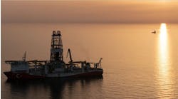
Fugro Geoservice's R/V Seis Surveyor is the only vessel in the Gulf of Mexico outfitted to aquire short-offset, high resolution 3D seismic data.
- Conventional 3D seismic profile [64,499 bytes].
- Short-offset, high resolution 3D seismic improves the stratigraphic and structural details observed within the shallow geologic section [83,444 bytes].
- Short-offset, high resolution 3D timeslice over shallow caprock within a developed field. The operational efficiency provides near-complete coverage without ocean bottom cable or two-vessel undershoots [52,788 bytes].
This resolution may be acceptable for large, deep reservoirs but is unacceptable for identifying shallow, localized subsurface features - either for deepwater hazards or shallow reservoirs. Previously, it was not economically feasible to collect high-resolution, finely sampled data in deepwater. Now, with improvements in seismic data acquisition, processing, computer hardware, interpretation and display, costs have decreased. High-resolution 3D seismic has become a cost-effective solution for subsurface hazard detection in deepwater and for reservoir exploration and exploitation of shallow reservoirs.
High-resolution surveys
The Geophysical Division of John E. Chance & Associates, now a part of Fugro GeoServices, has developed a short-offset, high-resolution 3D system specifically targeted to collect and preserve high frequencies, enhancing the resolution of small targets at shallow depths. Data collection techniques include: high sample rates, multiple cables, shallow cable depths, and source and streamer positioning systems.These are designed to give superb resolution in target zones. The data processing method preserves frequency content, whereas traditional 3D processing methods reduce frequency content in data.
With high-resolution 3D, spatial samples are closer together, as fine as 6.25 meters in each direction. Frequency content of the high-resolution 3D data can be more than 400 Hz. Data is sampled and processed at 0.5 ms, rather than the more typical 2 ms.
Fugro completed its first high-resolution 3D surveys in 1996 utilizing a single cable. The data quality was good, but single-cable collection was too slow and expensive. A single-cable operation collecting data in a 5 km by 5 km block at 15-meter line spacing required 333 sail lines. The sail lines totaled 1,670 km and required 23 field days to complete the survey.
To keep the data collection cost-effective, Fugro, in conjunction with Shell Deepwater Development, developed the first short-offset, multi-streamer high-resolution 3D seismic acquisition system for use in the Gulf of Mexico. The 6-cable, wide tow system surveys a 5 km by 5 km block with 66 sail lines, while still collecting 1,670 km of coverage. Data collection time has been reduced from 23 days to five field days.
Deepwater flowing sands
Shell's initial need was to map potential deepwater hazards, especially geopressured flowing sands. These are often encountered in deepwater drilling in the tophole section at about 1,000-3,000 ft beneath the mud line.Shallow flowing sands can literally wipe out a well but are difficult to identify with conventional 3D or high-resolution 2D data. Conventional 3D data often lacks the needed resolution, while out-of-plane effects can limit the interpretability of high-resolution 2D data.
High-resolution 3D provides improved spatial sampling of the shallow seismic section and increased preservation of the available bandwidth. By carefully mapping potential flowing sand zones, a casing program can be designed to minimize the dangers of the shallow sand flows and reduce costs by reducing the number of casing strings needed.
Vastar Resources used high-resolution 3D seismic data to define the sand-prone interval on its first deepwater well on the King prospect in Mississippi Canyon Block 764. According to Nat Usher, Director of Engineering Geophysics for Vastar, "When we drilled our No. 3 well, we encountered shallow water flow and lost the well. With high-resolution 3D, we were able to identify the problem zone and avoid it on well No. 4, which was only 600 ft away."
Now, with high-resolution 3D, operators have a data set that is suitable for planning "where to drill", as opposed to a 2D set showing "where not to drill." The detailed interpretation of tophole features include the ability to:
- Display an accurate representation of amplitude variations
- Delineate stratigraphic details
- Give a sharp, detailed definition of fault planes.
Shallow-water applications
Besides deepwater applications for assessing flowing sands and other hazards, high-resolution 3D has numerous applications for shallow-water reservoirs. Sonat Exploration used high-resolution 3D to exploit an area in 40 ft of water. A conventional 3D survey was optimized for deeper objectives, according to Gary Clack, Sonat Gulf of Mexico Supervisor of Seismic Processing."With a high-resolution 3D survey, we were able to delineate the caprock for enhanced production," Clack said. "In addition, we were able to identify subsidence zones and that kept us from positioning a rig in the wrong place." According to Clack, high-resolution 3D was much more cost-effective than using a conventional, 12-streamer 3D seismic vessel in such shallow depths.
Fugro's high-resolution 3D system deploys up to six streamer cables in a short-offset configuration. Short-offset cables are typically 100-200 meters in length. The advantage of short-offset technology in deep water is the reduced "data smear" (caused by long offsets) and the corresponding increase in frequency content and resolution.
An integrated navigation system is utilized to locate and track each hydrophone - on each cable, on each and every shot. Precise placement of the hydrophones and source is critical for the accurate positioning of the common mid-point (CMP) on the seafloor. The small bin size of high-resolution 3D (6.25 meters by 12.5 meters) requires better positioning than conventional 3D. Positioning of 3 meters or better is routinely achieved with the use of: Digicourse compass birds, Sonardyne Sips acoustic system, relative DGPS for tail buoys and guns, and I/O's integrated navigation system.
Onboard processing
Robertson Research International Ltd. (RRI), the developer of the short-offset processing technique, supplies the primary processing system and personnel for data processing onboard the Fugro Seis Surveyor. Acquisition and real-time processing of the data on board is ideally suited to the following technique:- Only short-offset traces with near-normal incidence raypaths are acquired and processed, typically up to 12 channels. The CMP "smear" is eliminated. CMP "smear" results from dipping strata when longer offsets are included and destroys high-frequency information.
- The data are not binned. The arbitrary repositioning of data during the binning process corrupts the integrity of seismic events, thus attenuating the higher frequencies. The distribution of data onto a regular grid - normally undertaken in the binning process - is, instead, effected during the subsequent migration.
- True amplitudes are honored throughout the processing sequence. Absolutely no data-dependent scaling is applied to the data, ensuring that high reflection coefficients (bright spots) are both recognizable and quantifiable.
- Signal-to-noise ratios in the low-fold, short-offset volume are recovered using a specially adapted migration algorithm whereby coherent signal is amplified and random noise is dissipated.
Short-offset, high-resolution 3D seismic has proven its value in deepwater well planning and shallow-water exploitation. More than a dozen high-resolution surveys have been completed, providing over half a dozen operators excellent high-quality, high-resolution 3D data sets for critical exploration and exploitation decisions.
In the future, high-resolution 3D will find utilization in deepwater fields in Brazil, the North Sea, and off West Africa. It will also find a growing use to fill the gap left by conventional 3D or OBC survey on the top and flanks of salt structures in the Gulf of Mexico.
Copyright 1999 Oil & Gas Journal. All Rights Reserved.


