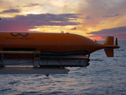
Ocean Infinity completes subsea survey for Total offshore Angola
Offshore staff
HOUSTON – Ocean Infinity has completed a geotechnical/seismic survey for Total E&P over deepwater blocks 17 and 32 off Angola.
According to the company, this was the first instance of geophysical, geotechnical, and seismic data being compiled at the same time.
It involved simultaneous operations of autonomous underwater vehicles with geotechnical and seismic equipment, all deployed and managed from one surface vessel (Normand Frontier) on a single voyage to the project site.
The 28-day campaign involved 2D ultra high-resolution seismic surveys and seabed soil sampling.
03/04/2020
