Vessel tracking system helps safeguard offshore infrastructure
Milan-based GeneGISGI has developed a service that allows offshore operators and contractors to monitor the movements of vessels transiting sea areas close to or over their infrastructure.
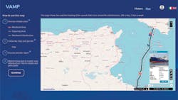
The Vessel Alert Monitoring Platform (VAMP) provides regular updates through combining the geographical position of the offshore facility with marine traffic information. Users can track approaching vessels in real time, receiving detailed reports informed by multiple signal channels, including Inmarsat and other satellite and terrestrial automatic identification systems (AIS). In addition, VAMP advises vessel crews of their proximity to the client’s infrastructure.
GeneGIS GI (formerly known as GESP) was established in 1977 as a small consultancy specializing in environmental assessment and civil engineering. From 1995 onwards, the company began providing software solutions and IT services based on geographical data - i.e. the Geographic Information System (GIS) - for different sectors including oil and gas and logistics.
Last year, it decided to merge with three other Italian service providers to form GeneGIS GI, the GI standing for Geographical Intelligence. The aim, according to Luca Raso (business development manager) was to enhance and expand its capabilities to supporting the entire lifecycle of any IT project based on geographical data, from the acquisition of raw data, processing and integration through the development and maintenance of bespoke software applications. All the companies that formed GeneGIS GI and their various specialists have worked for many years for the major international oil and gas companies and contractors, Raso added, providing offshore and onshore software applications.
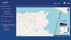
The VAMP system provides constant monitoring of vessels crossing or approaching offshore gas trunklines and cable systems. (Courtesy GeneGIS GI)
Today the organization employs around 80 technicians located in different sites in Italy (aside from Milan, it has offices in Torino, Bologna, and close to Naples). GeneGIS GI claims to have delivered high-profile geospatial projects in more than 20 countries, and via a network of partnerships, has provided solutions in Russia, Sub-Saharan Africa, Europe, Latin America, China, the Caribbean, and the Middle East.
Depending on the client’s needs, the company can adapt its service to interface with terrestrial AIS base stations along nearby coasts or via satellite. “The coverage provided by the satellite AIS technology offers the possibility to trace ships even in remote marine areas very far from the mainland,” Raso explained, “and this is a great advantage for those who have to monitor infrastructures with large linear extension such as gas pipelines or cable systems. Terrestrial AIS antennas positioned along the coasts provide less sea area coverage but ensure a much higher resolution and therefore more complete information. This is the right service for those who manage infrastructure close to the coastal strip.
“Typically, the company is hired by international and financial institutions such as the World Bank, United Nations, the EU, or international agencies such as Frontex and UNESCO. We adapt our easy-to-use solutions to assist the modernization process in developing countries or to support re-construction programs in countries affected by wars or natural disasters. Our track record offshore includes involvement in the maintenance operations of long-distance trunkline systems such as Blue Stream in the Black Sea, the Green Stream pipeline between Libya and Italy, and the Trans Mediterranean Pipeline taking gas via Tunisia to Sicily and mainland Italy.
“In certain parts of these and other seas there is a greater density of infrastructure and/or particularly heavy maritime traffic. In those areas, where there is a higher potential for damage due to collision by impacts or inappropriate anchors, the benefits provided by the VAMP service are especially important.”
VAMP is a fully end-to-end S.a.a.S (Software as a Service) solution that is entirely automated, with no need for any additional installation in the client’s offices. By connecting tohttp://vamp.genegis.net the user can send the GeneGIS GI team location-based information regarding the offshore assets that need to be monitored and protected. According to Raso, the system will then provide a comprehensive, real-time, easily accessible report of vessels that are sailing around the infrastructure, at the same time relaying alarm messages directly to the on-board communication systems to inform the ship’s crew that they are approaching sensitive marine infrastructure.
“An added bonus of VAMP is that it avoids the need for installation of sensors and/or interfaces between the system and the customer’s infrastructure,” Raso said. “It employs and integrates several advanced (and independent) technologies and protocols as Cloud, AIS, Satellite, Inmarsat communications, and GIS maps. This integration, based on an overall use of the concept of coordinates, allows it to determine near-real-time outcomes without any impact on the asset.
“For each customer, during the VAMP service activation phase, our team performs a preliminary analysis of the geometry of the infrastructure – layout, depth and so on – and of the geographical and operational context in which it is located. In this way all specific requirements or potentially critical issues are highlighted in order to optimize the service to deal with the greatest complexity such as the presence of frequent and heavy traffic.
“The next evolutionary steps of VAMP will include a more complete reporting and statistical functionality on the interaction of marine traffic in the vicinity of the monitored asset; the possibility to have different cartographic views also with better bathymetric detail.” •

