Seismic Interpretation 3D interactive interpretation and visualization
Dev George
Managing Editor
Next generation solutions are here, in tandem with the world's fastest desktop 3D graphics and imaging workstation
Seismic Interpretation
Until now, true 3D seismic interpretation wasn't possible. Thus, interactivity with 3D seismic data occurred only in the minds of interpreting geophysicists. But that is no more: a leading geophysical software producer, Landmark Graphics, has made the great leap by producing voxel-based 3D imaging software. In addition, a leading maker of performance graphics and imaging workstations, Silicon Graphics, has developed that workstation needed to utilize the software for genuine interactive 3D seismic interpretation.
In an unprecedented joint endeavor, Landmark Graphics, worked with Silicon Graphics to develop the fastest desktop 3D graphics and imaging workstation today, the Indigo2 IMPACT, and to provide a high performance, integrated visualization application, EarthCube, concurrently with the release of the Indigo2 IMPACT.
The Indigo2 IMPACT graphics system combines volume rendering and hardware texture mapping with traditional surface-based 3D graphics. This collaboration gives asset teams the ability to view, share, and manipulate 3D earth models comprised of integrated geophysical, geological, geometric, and engineering datasets. With the interactive graphics, digital media and high-end visualization capabilities of the Indigo2 IMPACT system, geoscientists can view seismic data, integrate geology and engineering data, and generate accurate, easy to understand 3D earth models in real time on an affordable workstation.
Generating 100 million trilinear interpolations per second for advanced visualization, the unequaled capabilities of the powerful Indigo2 IMPACT 3D graphics and imaging workstation result from a fusion of geometry and texturing capability that appears to be generations ahead of other desktop graphics systems. Features include photorealistic texture mapping, volume rendering, HDTV resolution, and professional digital media features. The High Impact version of the system sells for $35,000-45,000; a Maximum Impact model for $51,000-60,000.
EarthCube
EarthCube supports arbitrary data plane animation.
Landmark's EarthCube suite of software represents an a substantial advancement in 3D seismic interpretation, allowing truly interactive interpretation and visualization in three dimensions. Interactive performance means that the software keeps pace with the interpreter's thought processes. This impacts not only the interpretive cycle time, but improves the quality of the interpretation, thereby decreasing drilling risk.
Much exploration activity today centers around finding bypassed reserves in known reservoirs, which is more cost effective than finding new reserves. 3D seismic data helps to improve imaging of the reservoir. But, traditional workstation methods only allowed interpreters to examine a subset of the data -- as a series of two dimensional slices. EarthCube lets geoscience professionals interact with the entire 3D dataset, so no information is lost. In addition, volume visualization allows one to freely rotate the data cube so it can be examined from any orientation for a better understanding of the attributes and relationships in the seismic data.
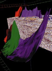
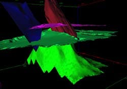
Surface visualization in EarthCube permits examination of relationships and attributes.
EarthCube's volume rendering is the key technology for true 3D interpretation. It enables selective rendering of seismic data according to a range of values and viewing of that data in three dimensions. With it, one can filter large data volumes to see spatial and data character relationships related to hydrocarbon deposits, and one is able to see the original data character unencumbered by interpretation, giving more confidence about the information being conveyed by the data.
EarthCube also supports arbitrary data plane animation. The additional dimension of movement enables the eye to see data changes as the new data clicks into view. This new animation provides a dramatic difference, because data planes can be animated in any orientation, allowing the viewer to move along dips, strikes, or through an interpreted surface.
EarthCube is fully integrated with Landmark's other geophysical software, Super SeisWorks, ZAP! III, and RAVE, to permit complete interpretation and analysis of seismic data attributes. Horizons and faults can be interpreted directly in EarthCube, however.
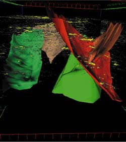
Volume rendering in EarthCube permits selectively rendered data.
Holistic approach
"We're taking a more holistic approach to understanding geological and geophysical phenomena," said John W. Gibson, Jr., Landmark's vice president for technology. "We want EarthCube to move the industry away from examining components and get people to seeing the whole. There's a synergy at work that can be seen and understood through integration, interactivity, and insight.
"The information we're trying to integrate spans a scale that is almost unprecedented in the amount of detail that we can put into it. We go from about 100-km models down to 100-meter scales, then down to the cores of about two feet, then down to a cm, when we get two thin sections out of a core, and finally down to 10 microns to examine porosity.
"It incorporates information that crosses this scale so you have the required detail down to about the cm level, and access to the information beyond the cm level down to about the micron level. It's an incredibly difficult process, an enormous scale of information.
"Furthermore, the information we can integrate comes from people of very different views and personalities - geophysicists, geologists, engineers, economists, etc. Production engineers are responsible for each one of the components that go down a hole - they design the pipe, the cement jobs, where you set packers, whether you gravel pack, etc.
"Reservoir engineers determine where the perforations are, which reservoir is to be drained next, how many perforations do you want to put in it, whether or not to complete it.
Drilling engineers are responsible for drilling the holes, and geologists are responsible for the lithological descriptions that go into the interpretation, up next to the wellbore four or five disciplines just on the downhole side."
Gibson noted that three or four years ago, a typical model might have incorporated 300,000-400,000 cells, but today a 10 km by 2 km by 200 meter model may have as many as 40 million cells. "The amount of information going into a model is growing at an unprecedented rate," he said, "but we've still got a ways to go; we need to be in the 40 billion cell models to deliver data down to the micron level. The problem is to animate such a large model. You have to have the motion to get the understanding - its critical."
The new technology represented by EarthCube is a major step toward the incorporation of all this information.
The purpose of this level of development, according to Gibson, is to gain insight that might not have been available any other way.
"I personally believe that EarthCube's level of graphics on the desktop is going to produce a discontinuity much like the paradigm shift from paper to 2D - its 2D to 3D. It going to permit a more holistic analysis of the data, versus a non-constrained analysis of the individual components, where you only know about the geophysics, or the paleontology, or geology, or whatever.
"We're beginning to get it all together and leveraging visualization to allow companies to have a holistic view of the decisions they're making. I believe that understanding is really going to make a difference, because the Indigo2 IMPACT system is so much more powerful. Having all the information in the same place makes the difference. The CPU that allows this dynamically and keeps up with the graphics is a co-equal. Over the next five years, the success rate of exploration and production wells is going to go higher and higher."
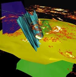
Volume visualization in EarthCube allows free animation.
Understanding terms:
2D texture mapping: In the 2D texture mapping process, the surface is triangulated, with a collection of triangles that give you an attribute surface, such as velocity. This then permits the "draping" of attributes such as amplitude information or phase or velocity on top of the triangulated surfaces to see how the attributes relate to the structure of the surface. Thereby the geoscientist is able to bring in numerous faults and horizons and interact with them rapidly.
3D texture mapping: A high-end application technology until now, 3D texture mapping allows the seismic data to be brought in for interaction, including rotating it and zooming in and out, applying different opacities and transparencies, and zeroing in on the most interesting data.
Voxel technology: A dot on the screen is a pixel, a two dimensional representation of a sample. In volume rendering, one moves into what is known as a voxel, where each is a 3D object, and associated with this object are two vectors: one is RGB and alpha and the other vector is XYZ, which defines in 3D where it sits in space. Essentially, the attribute is glued onto the surface - first the geometric representation, then the attribute representation. Finally, in 3D texture mapping, one moves to seismic volume. (EarthCube will only run on an SGI Indigo2 IMPACT product or on high end workstations.)
Copyright 1995 Offshore. All Rights Reserved.


