Surge of geoscience software enhancing processing and interpretation
Software development in seismic related programs has been steady over the past few years as geophysicists, geologists, and now engineers strive to extend the effectiveness of acoustic methods and incorporate other professional data sources. Significant advances in pressure wave acoustics are being enhanced by both shear wave acoustics and by new visualization technologies.
The need to pull more information together more quickly is forcing vendors to integrate products more completely. Systems and software are growing larger, more capable, and are available for a spectrum of computer systems and sizes.
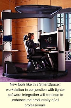
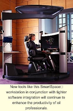
The standard two-headed workstation is evolving and transmuting into both smaller and larger versions. With the advent of new tools like Smart Space's personal workspace and multi-configuration virtual reality rooms, visualization technology is developing new ways to utilize the multitude of software products available. Below are some of the newer and more prominent software products seen at the recent Society of Exploration Geophysicists (SEG) convention held last month in Houston.
- Input/output: Veritas has developed a suite of database management products allowing optimization of input/output from Oracle databases and storage area networks (SAN). The products are designed for the whole enter prise but can be tailored for geoscience needs.
- Interpret 2000™: Landmark new software incorporates an "on-the-fly" seismic data compression method that provides immediate online access to volumes of data in the 100-200 gigabyte range. This permits the interpreter to review more data in less time.
- Open iT: This suite of software manages and distributes computing resources over a network. The advantage of this system is that it tracks license usage to both optimize use of licenses and prevent unauthorized use of licenses, a very expensive legal situation. It helps the licensee optimize all computer resources.
- LSF™: Platform Computing's product is designed for the distributed computing environment. It focuses on dynamic load sharing between the clustered computer systems available. This permits efficient execution of reservoir simulation studies, in parallel if needed.
- Earthwave™: GX Technologies' series of 2D and 3D velocity modeling and prestack depth imaging software can be used for modeling seismic responses prior of acquisition, during processing, or while interpreting to test and validate interpreted structures or seismic attributes.
- Echos 99™: Paradigm Geophysical's new software suite is a seamless seismic data analysis solution from survey design through image and attribute volumes. The main feature is a shared earth model using seamless workflows with multiple interpretation options. The common file system minimizes data duplication.
- Largo™: Jason Geosystems' new rock physics application is for the calibration and synthesis of Vp, Vs, density log suites, and fluid substitution modeling. Variables can be calibrated against selected input logs. The analysis and processing of logs uses a spreadsheet metaphor where each cell can be a complete log. The application is integrated with the other products in Jason's suite.
- Earthworks™: Genentech's integrated geo-analysis, modeling, and mapping workstation system operates on a high-end PC computer system. It is optimized for pre-stack analysis of seismic data.
- SeisVision 5.0™: Geographix' 2D/3D seismic interpretation system operates on the Windows NT desktop. It has 3D visualization and attribute extraction capabilities as well as dynamic integration with geological interpretation and log analysis.
- CoReExplorer™: Continuum Resources software is an advanced data browser for immersive virtual reality visualization. It permits asset teams to create multi-dimensional integrated and interactive landscapes of data that can be shared over TCI-IP networks. This permits experts in different locales to consult on projects without the delay and expense of world travel.
Other software
The landscape of seismic manipulation, grouping, analysis, and interpretation software is constantly changing. What is immerging is a tiered system of interrelated software that:
- Maintains databases
- Manages data distribution
- Optimizes computing power
- Creates visualization
- Enhances interpretation
- Offers special processing options
- Creates predictive models
- Delivers decision level information for management.
The future of seismic software integration
At the recent Society of Exploration Geophysicists convention, Victor Schmidt, Offshore Magazine's exploration editor, interviewed Eldad Weiss, Chairman & CEO of Paradigm Geophys ical concerning his views on the ever-changing world of seismic interpretation software integration. The following are the questions and his comments:
Offshore: The software offerings here appear very familiar. Where is the integrated software market going?
Weiss: I agree. There is a bit of confusion in the marketplace. The confusion comes from the clear signals to the vendors that the industry is looking for more integrated environments.
I think the confusion comes from the definition of what integration is really all about.
Paradigm's integration strategy is about embedding, making a single system in an object-oriented model like Microsoft's Office™ product. Rather than integrating on a common data bus, we have re-engineered our applications, unbundled them, and re-written them as one package. Seventy per cent of the individual code in a development effort is common: data handling, graphical user inter face, displays, installation procedures, and com mu nications. For example, our software is environment-independent and available for all industry computer platforms. We are trying to take the choice of hardware away from the user by telling the company to select the hardware environment that is best for its business environ ment, regardless of the software the users need.
Offshore: Are there any major hurdles in writing integrated geoscience software?
Weiss: The challenge beyond geoscience is to bridge the gap between geoscience and engi neers with physical data sets. It is more than just computer integration. It is about under standing the science behind the data. We are focusing our company to help transform and translate the complex data sets from the language of one science into the language of the other sciences that need to use the data: geophysics to geology and geology to engineering.
We are meshing seismic and logs to create data at a resolution required for engineer ing models. One program is the new reservoir characterization product suite, which closed the gap between geoscience and reservoir engineer ing. It helps professionals build geologic models from seismic data attributes, using a shared earth model for macro and micro reservoir property description.
Integration really is not about just pure com puter science or common databases. It is about the geophysics and physics of the data. The ability to use a common earth model, a common infrastructure; an ability to use hard science to understand the physical nature of the data and to translate it into another domain.
Offshore: Do you see software moving to a web-based system?
Weiss: I need to be cautious here, not to over-hype it. Geoscience applications are very computer intensive and require a lot of data. The reality is that for some operations (or countries), the web or the necessary bandwidth is not available.
There are some applications like report generation that can be web enabled. We are making our software web-enabled, where it is appropriate.
Offshore: What is the next direction?
Weiss: Streamlining. We are trying to streamline the bridge (between the professions) making it fully integrated. We must give the geologists the key ability to talk the language of the reservoir engineers and vice versa. They must communicate.
Currently, the industry is using different models for engineers and geoscien tists. Those models are not intercon nected. There are interfaces, but they are not unified. Our goal is to build a unified model that will support both the wave equation and the flow equation together.
Offshore: Will this lead to a new oil professional in the future?
Weiss: We can demonstrate a single unified system that can perform all the geoscience tasks. I believe the occupations need to change from the end-product interpretation to deliverables that oil company managements expect: cash flow projections, drilling plans, and production schedules. Once that happens, you will see that our professions will change.

