Opinion: The value of understanding waves
By Andrew Wallace, Miros Group
The need to better calculate wave activity in our seas and oceans has never been more critical.
The offshore industry continues to move operations into deeper waters and harsher environments. Operational boundaries are pushed, and work windows are reduced. More challenging, as well as changing, wave and weather conditions offshore remain an inherent risk for operations such as walk to work or scheduled inspection, maintenance and repair in the marine environment.
For an industry entering positive demand with further growth expected over the coming years, the need for operational efficiency combined with the safety of personnel offshore in more hazardous marine areas will be under increased pressure.
Monitoring offshore conditions
For companies operating in the maritime environment, it confirms the importance of continuing to identify ways to better monitor and share sea state data. This will ensure operations can be completed as safely and efficiently as possible.
The power of digitalization is driving the way companies work and what can be achieved. Digital transformation is helping to expand data sources and increase the industry’s knowledge and expertise, pushing boundaries and taking innovation to new levels.
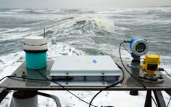
The use of advanced digital tools like dry-mounted, Internet of Things (IoT) and cloud-enabled sensors for ocean data collection and evaluation to gather real-time information about sea state or weather conditions is not only improving safety levels but achieving significant cost savings.
With such highly precise dry wave sensors, we are better equipped than ever to make a reliable, accurate assessment of the sea state, sharing information in real time with those responsible for making crucial decisions about the timing of operational activity and minimizing "waiting on weather," which is often scheduled into project plans years in advance.
Clearly, this is not an overnight process. Refinements in sea state monitoring have been advancing and developing for decades, in response to demand from the global marine offshore markets for ever more precise and reliable ocean insights, and the industry continues to push the boundaries of what can be achieved.
Vessel operations are often based on subjective observation, which is open to being challenged. Understanding the movement and activity of the waves and operators’ ability to carry out weather-sensitive operations often rely on a combination of weather forecasts and visual perception of sea state conditions.
This decision-making process is still in use today and perhaps a mariner’s instinct will always have a role to play, but the requirement for newer, more sophisticated, reliable and accurate methods of weather reporting at sea continues apace.
The drive for continued efficiency and change comes from an industry forced to reduce overall costs on projects and from contractors or vessel operators looking to minimize environmental impact while furthering a competitive edge, all while improving safety levels. Being able to provide comprehensive decision support covering all these needs, a trusted collaboration between the vendor and the user is a must.
Direct access to real-time sea state data
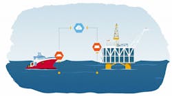
With a sea-state-as-a-service model, it is easy to retrieve and share data to all internal and external project stakeholders simultaneously. This gives stakeholders a comprehensive overview of environmental conditions as they develop, irrespective of personnel being based onshore or offshore. Also, it provides valuable support for vessel access planning, facilitating real-time decision support during operations, providing access to historical data for post-operation analysis and leading to improved confidence in numerical spectrum forecasts and refining alpha-factor.
Alpha factor is highly important for operations where wave height and period are crucial elements to contractual fulfillment. The Miros technology is accredited by DNV, providing clients with the assurance that the data they are receiving is accurate, and it can improve operability by expanding weather windows and minimizing time spent waiting on weather. Furthermore, allowing vessel operations to continue for longer periods of time results in cost savings and increased efficiencies during projects. Essentially, Miros aims to assist its clients in maximizing vessel operability.
Sea state data shared via a secure cloud solution in real time allows the marine sector to benefit from increased operational safety for the movement of personnel, significantly reduces costs compared to commodity wave measurement technology, and provides high data reliability and availability for notable operability improvements.
The most critical aspect is the ability to use real-time data combined with modeled or forecast data, which are being captured to improve safety and operational efficiency. Access to real-time information on sea state directly impacts decisions about conducting activities offshore or monitoring sea state during routine operations such as deployment of equipment, subsea installations, cable or pipelaying, or crew transfers.
About the author: With almost two decades spent working with vessel-based technologies, Miros Group’s vice president for offshore solutions, Andrew Wallace, brings a holistic approach to the delivery of data across organizations, along with key knowledge of important drivers for vessel operators.


