Offshore staff
BEIRUT, Lebanon – Lebanon’s Ministry of Energy and Water says pre-qualification is now open for the country’s first licensing round. Closing date for submission of pre-qualifying forms is March 28.
Interested companies are invited to visit a data room in Lebanon to view available technical reports and seismic data.
A first “Framework GeoPackage” is also available free of charge, which can be accepted after accepting the terms of the license agreement. This contains basic geographic data, seismic navigation, seismic examples, well locations, well summary sheets, surface geology and cross sections.
No wells have been drilled to date offshore Lebanon, although seven have been drilled onshore.
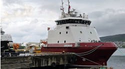
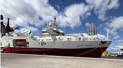
The Ministry says it has built up a comprehensive seismic data set covering the country’s entire offshore area, based on multi-client programs performed by PGS andSpectrum.
PGS’ data includes 3D seismic surveys acquired during 2008-2011, covering 9,700 sq km (3,745 sq mi), plus 9,700 line km (6,027 mi) of 2D data acquired during 2006-2012. The 2D package includes a GeoStreamer seismic program of 5,000 km (1,930 mi) targeting prospective leads and providing information on Lebanon’s offshore prospectivity.
Spectrum’s data includes 3D seismic surveys covering 3,000 sq km (1,158 sq mi), acquired last year, and 5,526 km (3,433 mi) of 2D data (1975-2002) recently reprocessed, with both time and depth migrated products available. These surveys, the Ministry says, provide structural insight into the basin and a detailed grid over Lebanese acreage.
2/19/2013


